Map of the country northwest of Jonesboro
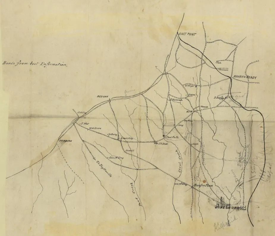
Map of the country northwest of Jonesboro, Georgia, Aug.–Sept. 1864 [Manuscript map]. (1864).
Library of Congress
Historical map of the Battle of Jonesboro
Map of the country northwest of Jonesboro, Georgia, August to September, 1864
Shows troop positions and names of commanders annotated in pencil.
Title and date from Stephenson's Civil War maps, 1989.
Pen-and-ink and pencil on tracing cloth.
Reference: LC Civil War maps (2nd ed.), S84, 187
Includes names of select landowners.
Imperfect: Fold-lined. Mounted on paper.
Library of Congress Geography and Map Division Washington, D.C. 20540-4650 USA
Learn More: The Battle of Jonesborough


Related Battles
Battle Facts
Clayton County, GA | August 31, 1864
Result: Union Victory
Estimated Casualties
3,149
Union
1,149
1,149
Confed.
2,000
2,000


