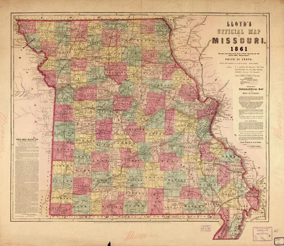
Lloyd's Official Map of Missouri - 1861
Historical map of Missouri
Lloyd's official map of Missouri Drawn and engraved from actual surveys for the Land Office Department.
Lloyd, James T.
New York, Louisville, [and] London, J. T. Lloyd, 1861.
Scale 1:760,320.
Reference: LC Civil War maps (2nd ed.), 296.2
"Entered, according to Act of Congress, in the year 1861 by J. T. Lloyd."
General map of the state indicating county names and boundaries, cities and towns, railroads in operation and projected, roads, and rivers.
Includes advertisements for "Lloyd's great military map of the fifteen southern states" and "$100,000 Topographical map of the state of Virginia."
Description derived from published bibliography.
Library of Congress Geography and Map Division Washington, D.C. 20540-4650
Learn More: The War in the West