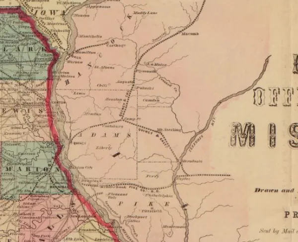
Historical Map of Missouri
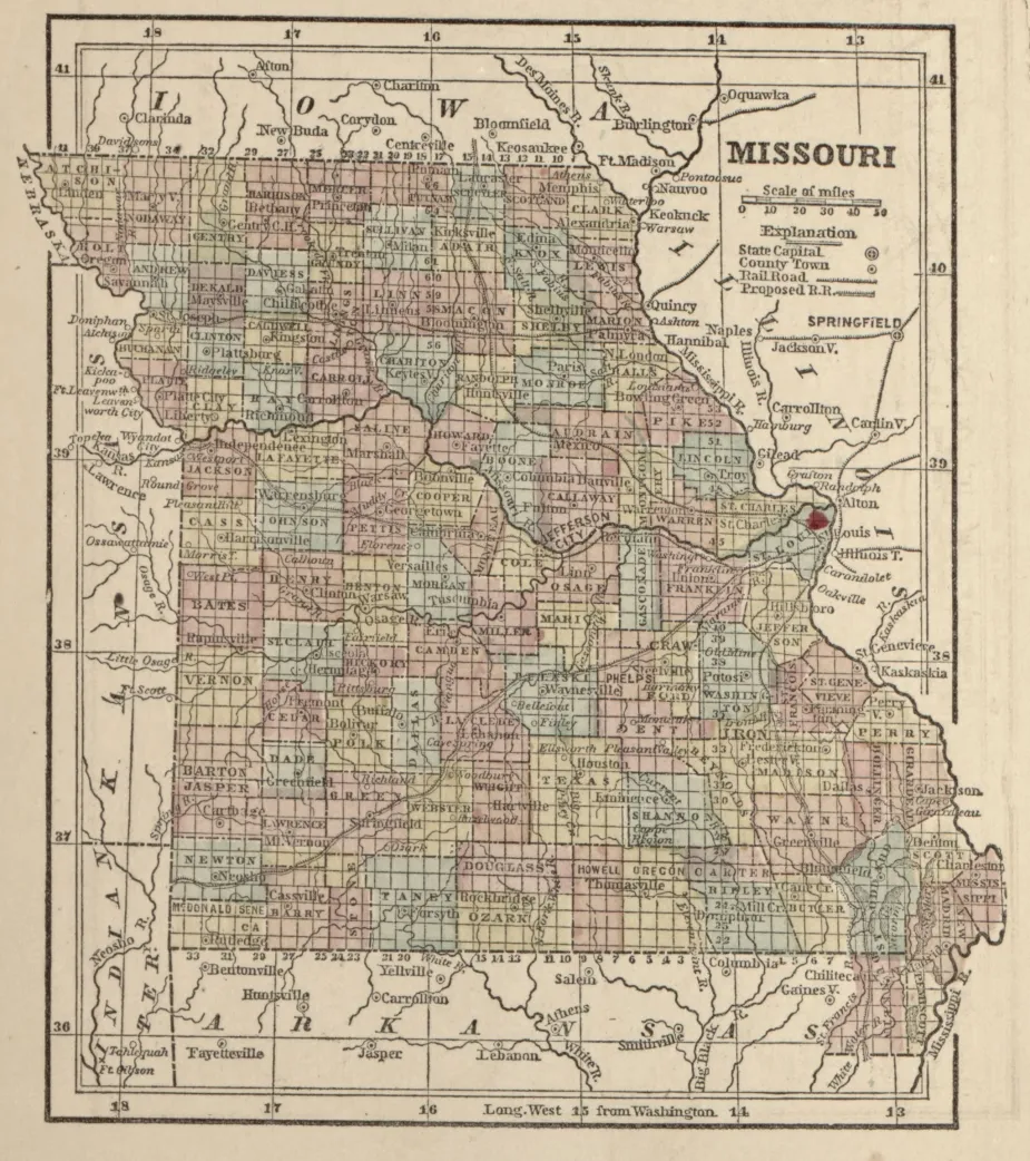
Missouri, from The Campaign Atlas, for 1861: United States, 1861. By Samuel N. Gaston.
Library of Congress
-
Historical Map of the Western Theater
-
The campaign atlas, for 1861 : [United States].
- Description
- Relief shown by hachures. LC Civil War Maps (2nd ed.), 12.2 Phillips, 1351 Available also through the Library of Congress Web site as a raster image. Includes United States map indicating "cantonments and strategic points" and state maps of Delaware, Maryland, Virginia and proposed West Virginia, North Carolina, South Carolina, Georgia, Florida, Alabama, Mississippi, Louisiana, Arkansas, Missouri, Kentucky, Tennessee, and Texas. Original paper cover bound into LC copy. Front cover identical to title page.
- Contributor Names
- Gaston, S. N. (Samuel N.)
- Created / Published
- New York : S.N. Gaston, 1861.
Learn More: The Western Theater