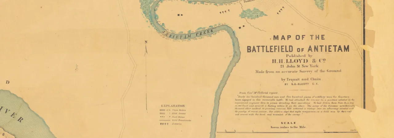
S. G. Elliott's Map of the Battlefield of Antietam amounts to a burial map of the Union and Confederate dead — even their horses are mapped. While this map was created in 1864, just like famous one for the Gettysburg battlefield, it lay in in the New Public Library's collection, unknown to most scholars, until recently. It was digitized in 2018 and uncovered by historian Timothy H. Smith and Andrew Dalton, Executive Director of the Adams County Historical Society in Gettysburg, Pennsylvania.
Now, this resource can lead to new insights about the battlefield and and unlock stories about the thousands of soldiers who gave all.
The Story of the 15th MA
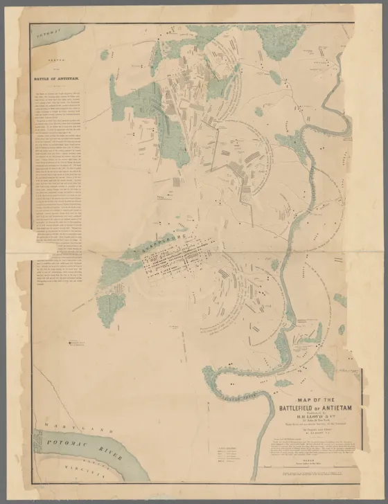
The graves identified, are generally in the location where each regiment fought. Surprisingly, the 15th Massachusetts, which suffered 330 killed and wounded out of 606, is only represented by a few graves marked near the East Woods. A letter written days after the battle, might shed some light on where the men of the regiment were buried and also identify a grouping of Union soldiers not identified on the Elliott Map. Pvt. Roland Bowen wrote the the father of his friend, Henry Ainsworth, days after the battle.
"Let me tell you about this particular trench and it will suffice for the whole. The trench in which Henry is buried is situated near a log cabin just out side the garden fence. I believe its on the West side. The trench was 25 feet long, 6 feet wide and about 3 feet deep. The corpse were buried by Co., that is the members of each Co. are put together. Co. H was buried first in the u[p]per end of the trench next [to] the woods. They are laid in two tiers, one [on] top the other. The bottom tier was laid in, then straw laid over the head and feet, then the top tier laid on them and covered with dirt about 18 inches deep...Then there is a board put up at each end of the trench with the simple inscription, ‘15th Mass. buried here.’ There is 39 men in the trench with Henry."
There certainly are a few discrepancies between the map and Bowen's letter, but considering the task at hand, it is plausible that the graves marked just north of Locher's are men from the 15th Massachusetts. Only 7 of the 117 that died at Antietam were identified and re-interned in the National Cemetery. Henry was returned home to Millbury, MA at some point, where his grave is located today.


It appears the only mention of the 15th Massachusetts on the Elliott Map, would be a few lone graves near the East Woods. This regiment saw their heaviest fighting in the West Woods, where they were caught in a terrible crossfire and lost 117 killed. Another regiment swept up into the Union disaster in that part of the field was the 42nd New York, who lost 41 killed.
The Elliott Map labels a group of two long rows, consisting of 95 Union soldiers, in essentially the exact potion held by the 15th Massachusetts in the West Woods. We know with certainty they aren't all from the 42nd NY since that regiment only lost 41. Is it then possible that this grouping is the burial location of the men from Massachusetts and not New York?
Who Was S. G. Elliott?
S. G. Elliott allegedly created one of the most famous maps of the Gettysburg Battlefield. But who was he? And was his work original, or plagiarized? While searching for the identity of this elusive map-maker, Andrew Dalton discovered the life-story of notorious railroad swindler Simon G. Elliott.