Sketch of portions of seacoast of South Carolina & Georgia
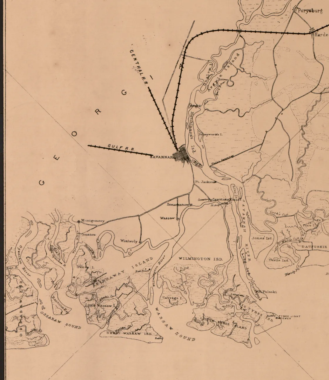
Sketch of Portions of Seacoast of South Carolina & Georgia, 1862. By A. and Henry Lindenkohl for the U.S. Coast Survey.
Library of Congress
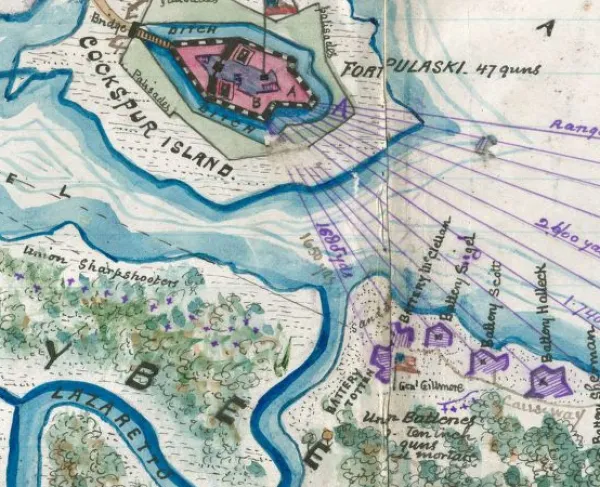
Historical map of the Battle of Fort Pulaski
A section of an 1862 map detailing the South Carolina and Georgia coasts
Note: This is a section of a larger map
U.S. Coast Survey, 1862.
Map of the coast from Bull's Bay, South Carolina, to Ossabaw Sound, Georgia, showing forts, drainage, roads, railroads, and towns.
"References" at the bottom center of the map give dates on which forts were captured by the Federal forces.
Lindenkohl, H. (Henry)
Library of Congress Geography and Map Division Washington, D.C. 20540-4650 USA
Digital ID
Learn More: The Battle of Fort Pulaski