Northern Florida - Lindenkohl
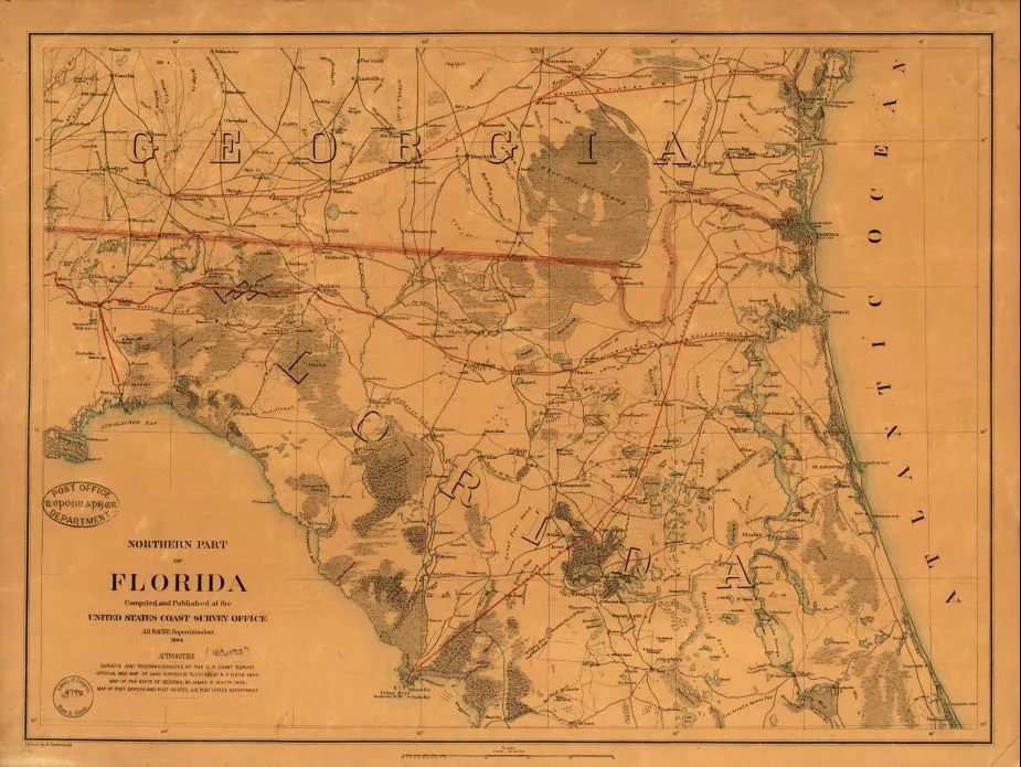
Northern Part of Florida, 1864. By Henry Lindenkohl and the United States Coast Survey.
Library of Congress
Historical map of Florida
Northern part of Florida Drawn by H. Lindenkohl.
Compiled and published at the United States Coast Survey Office, A. D. Bache, Superintendent. 1864.
Lindenkohl, H. (Henry)
[S.l.], United States Coast Survey Office, 1864.
Scale 1:633,600.
Reference: LC Civil War Maps (2nd ed.), 117.3
General map of northern Florida and southern Georgia extending from Altamaha Sound, Georgia, to 290 North latitude.
Description derived from published bibliography.
Library of Congress Geography and Map Division Washington, D.C. 20540-4650
Learn More: The Battle of Olustee


Related Battles
Battle Facts
Baker County, FL | February 20, 1864
Result: Confederate Victory
Estimated Casualties
2,807
Union
1,861
1,861
Confed.
946
946


