Map of the battlefield of Antietam
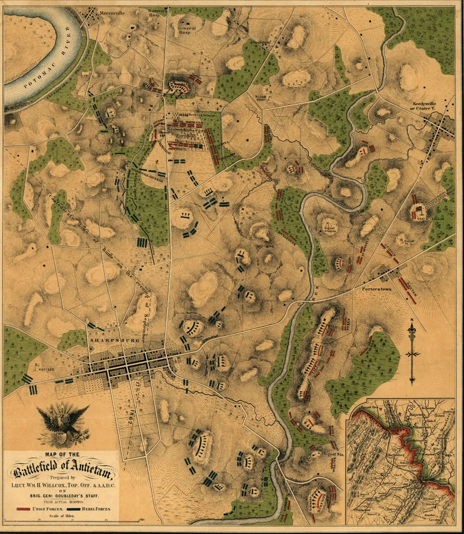
Map of the Battlefield of Antietam, 1862. By William H. Willcox. Lithographed by P. S. Duval & Son. Courtesy of the Library of Congress Geography and Map Division.
Library of Congress
Historical map of the Battle of Antietam
Map of the battlefield of Antietam
prepared by Lieut. Wm. H. Willcox, Top. Off. & A.A.D.C. on Brig. Genl. Doubleday's staff. [Sept. 17, 1862].
Willcox, William H.
Philada., Lith. of P. S. Duval & Son, [1862]
Scale ca. 1:13,300.
Reference: LC Civil War Maps (2nd ed.), 252
Handwritten inscription in the upper right-hand corner reads "Lieut Crawford with compts of Lt. Wm. H. Willcox."
Shows roads and streets, houses, fences, vegetation, drainage, hachures, and troop positions.
Inset: [Map of the environs of Sharpsburg] 12 x 10 cm.
Description derived from published bibliography.
Library of Congress Geography and Map Division Washington, D.C. 20540-4650
Learn More: The Battle of Antietam


