Battle of Gettysburg - Ditterline
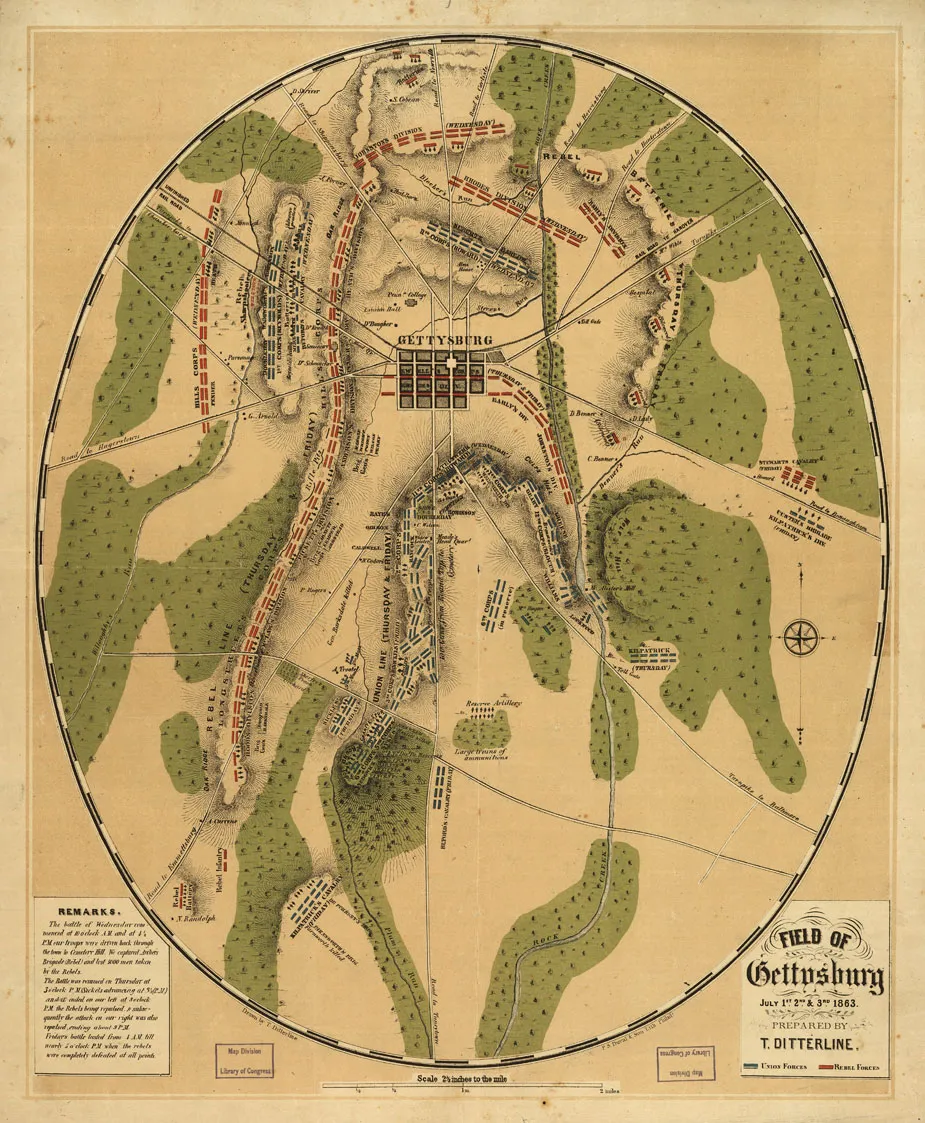
Field of Gettysburg, July 1st, 2nd & 3rd, 1863, 1863. By Theodore Ditterline. Lithographed by P. S. Duval & Son.
Library of Congress
Historical map of the Battle of Gettysburg
Field of Gettysburg, July 1st, 2nd & 3rd, 1863 Prepared by T. Ditterline.
[Philada. P. S. Duval & Son lith. 1863]
Scale ca. 1:25,500,.
Reference: LC Civil War Maps (2nd ed.), 331
From his Sketch of the battles of Gettysburg . . . New York, C. A. Alvord, 1863. 24 p.
Oval-shaped map depicting troop and artillery positions, relief by hachures, drainage, roads, railroads, and houses with names of residents.
Description derived from published bibliography.
Library of Congress Geography and Map Division Washington, D.C. 20540-4650
Learn more: The Battle of Gettysburg


CalltoArms
Help Save Historic Land at Antietam & Gettysburg
We have a rare opportunity to protect three parcels—two at Antietam and one at Gettysburg. With an exceptional $3.95-to-$1 match, every dollar given...
Related Battles
Battle Facts
Adams County, PA | July 1, 1863
Result: Union Victory
Estimated Casualties
51,112
Union
23,049
23,049
Confed.
28,063
28,063


