Archaeology 101
Modern machines have revolutionized the field and made it a truly 21st-century science. Where once, huge grids were systematically excavated in the hopes of finding a single artifact, today’s technology allows professionals to peak beneath the surface and know they’ve found a target-rich environment before ever lifting a trowel.
Here are some key things to know:
Archaeologists aren’t specialist historicans
“Archaeology and history can be very different things,” says AVAR CEO Stephen Humphreys, who holds a doctorate in the former field. “An archaeologist is a professional digger, in a sense, and can, conceivably, go to a site anywhere on the planet and, with a little indoctrination, set to work. It absolutely does incorporate history in a contextual sense, but for us, it’s much more tactile. Our goal is finding the things that they didn’t write about in the history books, which can be colored by bias that crept into the textual records. Archaeologists come in and ground what we know in the site itself.”
So while an archaeologist might be able to identify an artifact on sight the instant it gets the dirt brushed off, even if they have significant experience in that era, they need to work with historians to fully contextualize the items they uncover.
Artifact verses feature
An artifact is any discreet item made, modified or used by people that can be removed from its archaeological context. A feature is a physical structure or element — such as a wall, post hole, pit or floor — that is made or altered by humans but is not portable and cannot be removed from a site.
Conservation and cultural resources management
Conservation is the branch of archaeology that occurs in the lab after field work is completed. It involves stabilization, preservation, repair or reconstruction of artifacts. Layers of rust, for example, might need to be removed before an artifact is clearly visible. Or ceramic fragments pieced together to determine what kind of vessel they originally formed. Cultural resource management (CRM) is the broader profession that focuses on the management and preservation of cultural resources, including both archaeological sites and artifacts.
Data verses datum
A tremendous amount of information, or data, is systematically recorded for each artifact removed from a site, among which is the position in which it was found relative to a fixed reference point, called the datum. To aid in organization and analysis, each artifact is given a unique identification number that conveys where it was found on the site.
Dig, survey, excavation
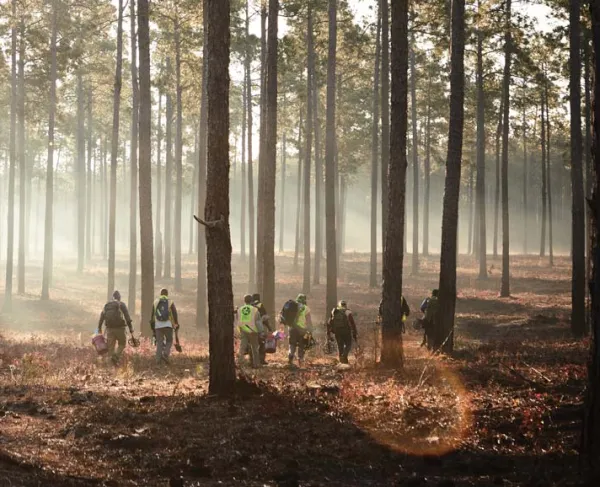
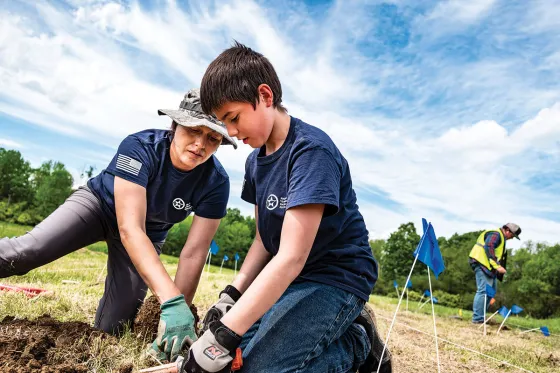
Until fairly recently, the key characteristic of archaeological work was digging in the dirt across the entirety of a pre-identified area. These days, there is significantly less time spent with trowels in hand, but the field work process is still almost universally called a “dig” — it’s a descriptive and evocative term that seems unlikely to be lost, even as the process continues to evolve. More properly, all of initial investigative work done on a site is called the survey, and the systematic removal of soil in search of objects in areas identified by the survey is the excavation. To be scientifically worthwhile, the excavation process must also record the provenience, context and three-dimensional location of finds.
The dirt on dirt
Technically speaking, any substance in which artifacts are found suspended — although it’s typically soil — is called the matrix. As excavation proceeds downward, layers, or strata, are revealed. The profile is the exposed cross section showing these layers in relation to each other. When a wall of dirt is left between two excavated areas, partly to keep a record of these layers, it is called a balk. Before large-scale excavations begin, a test pit may be dug solely to determine the depth and character of these strata.
Hand tools of the trade
Even in the 21st century, archaeologists do excavate by hand using fairly ordinary tools — shovels, trowels and the like. Having been buried for centuries, artifacts rarely emerge pristine; paintbrushes or toothbrushes are helpful in dislodging dirt so that an item’s identity can emerge. Soil is also passed through mesh screens to separate any small artifacts, often transported to the screening area in wheelbarrows.
Provenance and provenience
Despite remarkably similar pronunciations, these terms have distinct meanings. Provenance is the chain of ownership, including origin, of an archaeological or historical object. Provenience is the three-dimensional context (including geographical location) of an archaeological find.

Remote sensing methods
Technology has created a variety of nonintrusive survey methods used to find archaeological sites and identify potential artifact locations. These include:
LiDAR: Originally a portmanteau of “light” and “radar,” LiDAR is now used as an acronym for light detection and ranging. It uses precise streams of light to measure distances to the earth, producing incredibly detailed 3D maps and images of that surface — an aircraft equipped with LiDAR can detect a single likely gravesite.
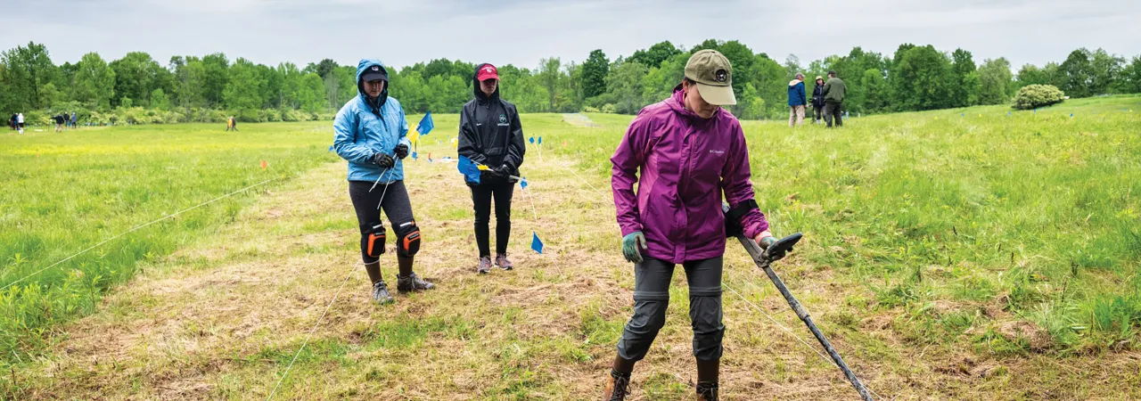
Ground Penetrating Radar: Often abbreviated GPR, ground penetrating radar lets archaeologists see what’s underground before digging in. High-frequency electromagnetic pulses are directed down into the soil and, if they strike an object, bounce back. The time elapsed provides information on depth, and the angle of the return can indicate shape, material composition and other details to a specialist operator.
Electrical Resistivity: Similar to radar techniques, archaeologists can also measure changes in the flow of electrical or radio waves as a means of identifying anomalies that may indicate buried artifacts or features.
Magnetometry: Mapping any variation in a site’s magnetic field can also pinpoint potential artifacts. The utility of such surveys is helping even handheld metal detectors, once considered the domain of amateur relic hunters out for personal treasures or looters in search of profit, undergo a rehabilitation in the eyes of professional archaeologists.
Slicing a site
Before excavation begins, the identified site is sectioned off into a grid, with each subsection called a square. A transect is a linear area of land that is sampled to determine the presence of artifacts. Trench is a slightly more flexible denotation for a single excavation area, having come into use before archaeology was as scientifically rigorous, and is used particularly when excavation units are rectangular.