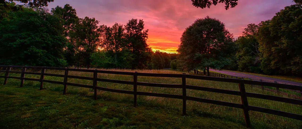
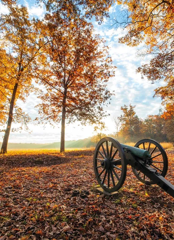
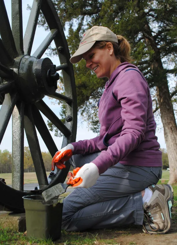
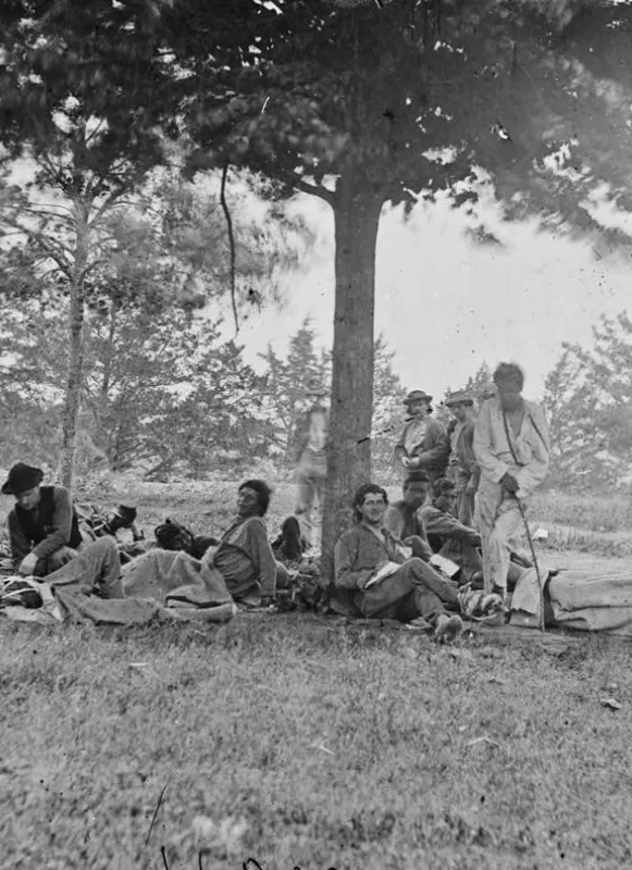
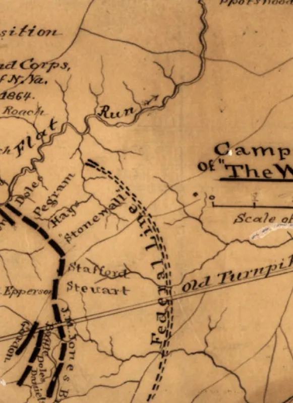
The Wilderness, Spotsylvania and Orange Counties, Va.
Struggle Against Mega-development at Wilderness Battlefield Continues
The controversial Wilderness Crossing proposal stands to see a massive development — including millions of square feet of data centers — impinging on the battlefield’s historic landscape.
Update: On September 16, 2025, Circuit Court rules challenge to Wilderness Crossing mega-development may proceed
A lawsuit challenging the sprawling Wilderness Crossing mega-development at the gateway to the Wilderness Battlefield may proceed, a judge ruled in a key legal victory for the American Battlefield Trust, other preservation groups and local homeowners seeking to protect historical and cultural resources from irrevocable harm by that project. Learn more about this decision.
Lawsuit
On the same evening it first appeared on the Board of Supervisor’s agenda, the Wilderness Crossing project — by far the largest rezoning in Orange County history — was approved despite overwhelming public opposition. Moreover, the plan voted on by the Board of Supervisors differed significantly from what was discussed and advanced by the Planning Commission just a few weeks prior. Yet, much of this pertinent information was intentionally obscured and not appropriately evaluated.
Identifying significant failures in both the substance of the proposal and the process by which it was approved, the Trust believes that the rezoning vote was fundamentally flawed and, together with other regional nonprofits and private citizens, filed a legal challenge in Orange County Circuit Court in May 2023. A second, parallel suit against the County filed by the Piedmont Environmental Council (PEC) over alleged violations of the Virginia Freedom of Information Act revealed that Amazon has been behind the controversial proposal since at least April 2022.
In March 2025, our lawsuit faced a demurrer hearing, or a motion by the defendants that we do not have a valid legal claim and therefore should not be allowed to advance to a trial. After substantial deliberation, the court ruled on September 16, 2025 that four of our seven charges would to continue to trial. This is a major victory, but it does not yet protect the Wilderness Battlefield. The trial date has not yet been set, but we are already preparing to mount our case that the Orange Board of Supervisors made several critical missteps in their handling of the rezoning which invalidate it.
Orange County Resources
Allied Opposition
The Trust is not alone in standing against this mega-development.
Since the Wilderness Crossing mega-development was first proposed in 2022, the Wilderness Battlefield Coalition has raised tough questions about the impacts of the development on the Wilderness and Chancellorsville battlefields, along with other environmental and historic resources along the Route 3 corridor. The Wilderness Battlefield Coalition is composed of 11 national, regional and local preservation organizations. All 11 groups have been active in advocating against the Wilderness Crossing development as proposed.
In May 2024, the National Trust for Historic Preservation identified the Wilderness as one of the 11 Most Endangered Historic Sites in the nation because of the threat posed by the Wilderness Crossing development. In November 2024, the Piedmont Environmental Council released a new video about the threat posed by data centers to the Wilderness and other battlefields.
Beyond the American Battlefield Trust, the lawsuit to overturn the rezoning, includes the Central Virginia Battlefields Trust and Friends of Wilderness Battlefield, as well as local homeowners, as plaintiffs. Amicus curiae briefs filed in support of the challenge, one by the National Parks Conservation Association, National Trust for Historic Preservation and the Coalition to Protect America’s National Parks, and another by the Piedmont Environmental Council (PEC), detailed the extraordinary investments that have been made to preserve the Wilderness Battlefield and the serious threats that the Wilderness Crossing development portends for that sacred ground. PEC also legally engaged regarding Freedom of Information Act issues with Wilderness Crossing in a separate lawsuit, and produced a bounty of outstanding materials about the impact of data center development in Virginia.
On May 1, 2024, the dire situation led the National Trust for Historic Preservation to include the Wilderness on its annual list of the country’s 11 Most Endangered Historic Places from the National Trust for Historic Preservation. Preservation Virginia has also repeatedly included battlefields threatened by data center development on its statewide watchlists.
Join historic preservation activists from across the nation by signing our petition urging protection of the Wilderness — and the numerous Virginia battlefields threatened by data center developments.
You can also make a donation specifically to support the Trust’s advocacy work on behalf of hallowed ground, helping defray our legal costs at the Wilderness and Manassas, and holding the line against inappropriate development elsewhere.


Proposal
A massive residential and commercial development – the largest in Orange County history – has been proposed at the gateway to the Wilderness Battlefield where it would impact adjacent core battlefield land and loom over the Congressionally authorized boundary of the Fredericksburg and Spotsylvania Battlefields National Military Park. At stake is the rezoning of more than 2,600 acres that could result in: more than 5,000 residential units, 200,000 square feet of mixed-use commercial development, and 732 acres of data centers and distribution warehouses.
It isn’t just the battlefield that stands to suffer. If this mega-development is allowed to move forward, growth will come at the cost of current residents’ quality of life. Already congested roadways will be utterly overwhelmed by nearly 50,000 new vehicle trips along the area’s major arteries each day. Resident services will be stretched to the breaking point and beyond.
Once again, we ask local residents and preservationists advocates to take a stand against this massive development project near the Wilderness Battlefield. Please speak out today to demand the county adhere to its own guidance for development in this sensitive area.
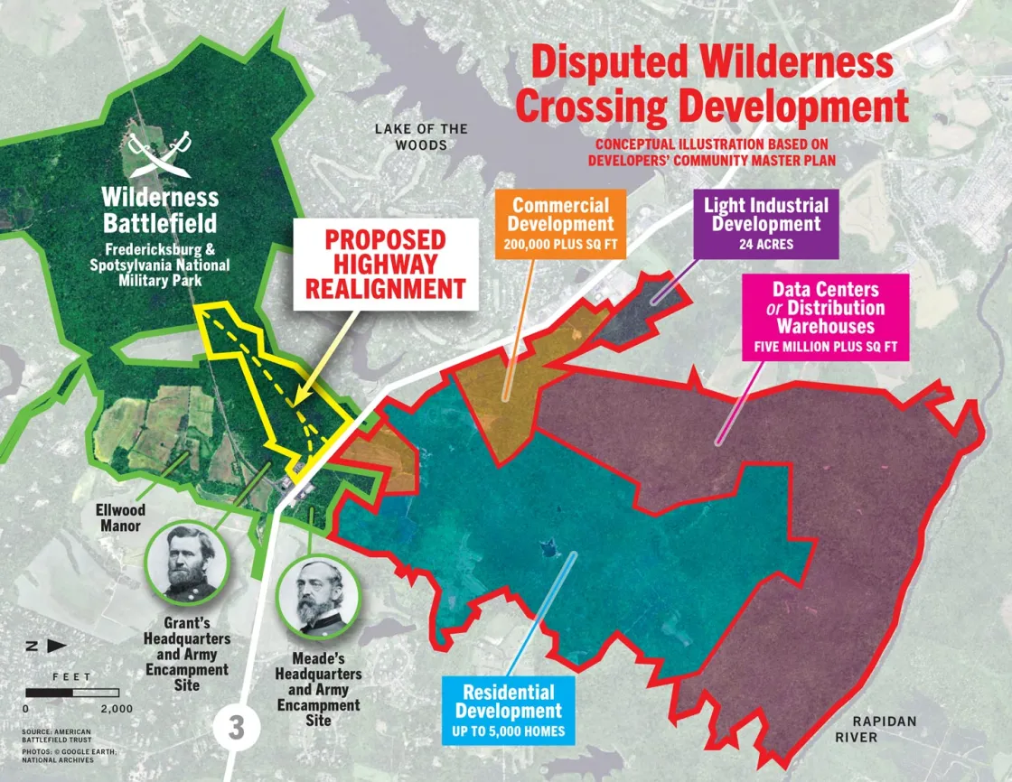
The Wilderness Crossing mega-development is poised to bring huge swaths of development across multiple categories – from single-family homes to data centers, distribution warehouses and other light-industrial uses.
Wilderness Battlefield CoalitionCoverage of Wilderness Crossing Proposal
Past Threats
Worse still, the current controversy is centered on a site we’ve fought for before. For several years, preservationists engaged in an advocacy campaign urging Walmart to relocate a proposed supercenter away from the gateway area. In 2013, that situation was fully resolved in win-win fashion when Walmart opened a store a short distance away and even donated the original 50-acre site to the Commonwealth of Virginia.
Instead of being satisfied with that result, the preservation community decided to be proactive. The Wilderness Gateway Study – a multi-year community discussion spearheaded by the Wilderness Battlefield Coalition and undertaken by the Hill Studio consulting firm – sought to establish a clear vision for the land surrounding Wilderness Battlefield, blending preservation and development as a gateway to the battlefield, associated landscape, and the community of Eastern Orange County.
In 2015, Orange County created its own Germanna Wilderness Area Plan that outlines need for a higher standard of design — centered around the community’s connectivity. Similarly, the Wilderness Battlefield Gateway Study — developed on behalf of the Trust and its partners — advocated for a model of development that would emphasize preservation of open space while allowing development to the Route 3/Route 20 intersection that would preserve the county’s rural lifestyle while minimizing damage to the battlefield.
Unfortunately, the current Wilderness Crossing proposal abandons the goals, philosophies and hard-won wisdom that underpin these documents.
Explore the History

Gateway Study
Phase I
In April 2012, after more than a year of public meetings and intense research, the Wilderness Battlefield Coalition announced the findings of its study of the Wilderness Battlefield gateway region. The objective of the study was to present potential, preservation-friendly development patterns and strategies that support heritage tourism while simultaneously providing services for residents, improving economic vitality in the Wilderness Region.
Throughout the course of a year, the team – full of landscape architects, planners, economists, transportation engineers, public and private stakeholders representatives – discussed land development and preservation issues in the area. Led by Virginia-based consulting firm Hill Studio, the team met with the entire group of stakeholders three times over the course of the project, and held two larger gatherings open to the general public. Additionally, the team also held a series of individual meetings with local leaders and members of the media to provide updates on the project’s progress.
The recommendations of Phase I were diverse and multi-faceted and included three scenario concepts that illustrated different combinations of the development patterns recommended in the report by Hill Studio.
Phase II
In November 2012, Phase II of the Wilderness Battlefield gateway report was released. The report was a result of the continuous intensive discussions among participating stakeholders and provided a consensus-based Preferred Development Plan for the Wilderness Battlefield gateway area.
The Preferred Development Plan recommended a more specific, desired location for a traditional, mixed-use Wilderness Village, planned business campus, guideline commercial area for Route 3, supported public infrastructure, and a regional park along the Rapidan River. The collaborative work refined the three scenario concepts that were presented in Phase I of the study and established focused direction for managing development in the gateway area. The Plan integrated the cultural resource, economic and transportation analysis of the initial study and used a recommended “kit of parts” to promote desired conservation and development patterns. The vision outlined in the Phase II report represented an important milestone in advancing land planning for the gateway.
The collaborating parties intended the Preferred Development Plan to be a document-of-reference for the Orange County Comprehensive Plan, to encourage planned, compatible develop appropriate to the gateway’s historic setting. Elements of the Gateway Study were ultimately incorporated into the County’s Germanna Wilderness Area Plan.


