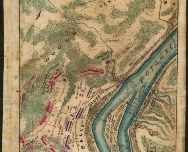
William Francis Bartlett Map - Battle of Ball’s Bluff
William Francis Bartlett Map - Battle of Ball's Bluff
Historical map of the Battle of Ball’s Bluff
The William Francis Bartlett Map of the Battle of Ball’s Bluff
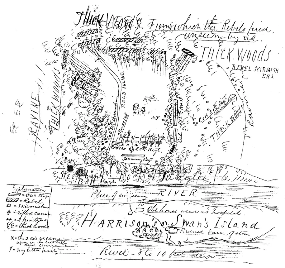
Captain William Bartlett of the 20th Massachusetts generated this hand-drawn map shortly after the battle. It is considered to be the most authoritative early map of this 1861 battle near Leesburg, Virginia.
Map drawn on or about October 24, 1861
Learn More: The Battle of Ball’s Bluff


Related Battles
Battle Facts
Loudoun County, VA | October 21, 1861
Result: Confederate Victory
Estimated Casualties
1,157
Union
1,002
1,002
Confed.
155
155


