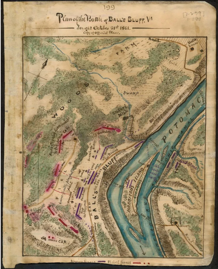
Plan of the Battle of Ball’s Bluff Va. Fought October 21st 1861
Historical map of the Battle of Ball’s Bluff
Plan of the Battle of Ball’s Bluff Va. Fought October 21st 1861.
Sneden, Robert Knox, 1832-1918.
[1861-1865]
Shows the Potomac River in the area of Loudoun County, Va., and Montgomery County, Md., where Union troops under Col. Edward D. Baker faced Confederate troops commanded by Evans. What was meant to be a "a slight demonstration" against the Confederate forces guarding the fords quickly became a rout. Col. Baker was one of the casualties.
Color coding shows location of Union and Confederate forces.
Relief shown by hachures.
This item is from the collections of the Virginia Historical Society; please contact the institution for more information.
Robert Knox Sneden Scrapbook (Mss5:7 Sn237:1), Virginia Historical Society, Richmond, Va.
In the Robert Knox Sneden Diary (Mss5:1 Sn237:1 v. 1, p. 282).
Manuscripts
1 map : pen-and-ink and watercolor ; 13 x 15.5 cm.
Virginia Historical Society, P.O. Box 7311, Richmond, VA 23221-0311 USA
Learn More: The Battle of Ball’s Bluff