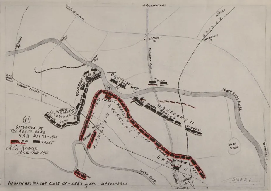
Movement to North Anna from Spotsylvania, May 21-26, 1864
Historical map of North Anna
Movement to North Anna from Spotsylvania occuring between May 21-26, 1864
The North Anna and movement from Spottsylvania [sic], May 21-26, 1864 between Lee, 50,000 and Grant, 100,000 / a series of 12 pen and ink maps drawn by Mr. Robert E.L. Russell. - No 11 - Situation at the North Anna - 9 A.M., May 25 -1864
Russell, Robert E. L.
[Baltimore : s.n., 1931-1933]
"Lee's famous "hog-snout" line."
"Read numerically."
Maps 1 to 4 are dated 1933.
Annotated in pen-and-ink, crayon and pencil with blank leaves at end. Confederate troop positions are colored red.
Reference: LC Civil War Maps (2nd ed.), 591
Reference: LeGear. Atlases of the United States, 10663
Call no. cited in LC Civil War maps (2nd ed.): G1292.S6S5 .R83 1933 folio.
Library of Congress Geography and Map Division Washington, D.C. 20540-4650 USA
Learn More: Battle of North Anna


Related Battles
2,600
1,600


