Map of Second Manassas, Virginia (1862)
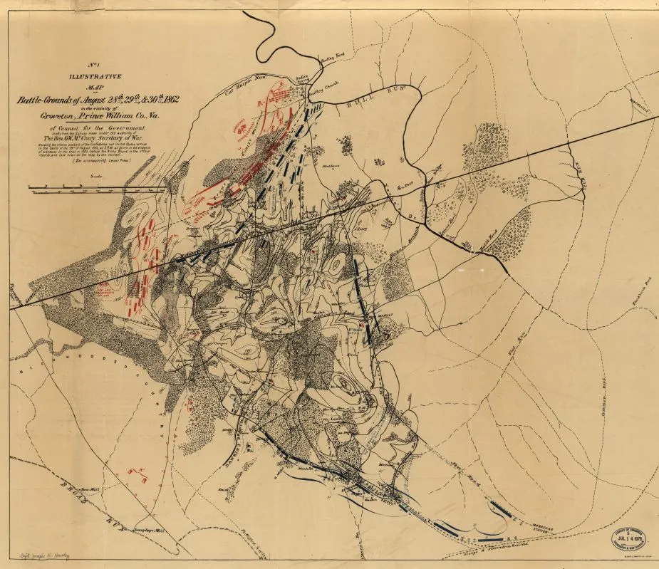
Historical map of the Battle of Second Manassas
Illustrative map of battlegrounds of August 28th, 29th & 30th, 1862
In the vicinity of Groveton, Prince William Co., Va. : of counsel for the government, chiefly from the survey made under the authority of the Hon. G. W. McCrary, Secretary of War.
[Washington : War Dept., 1878?]
Scale ca. 1:22,500.
LC copy annotated in ink on verso: Maj. Gardner's map, adopted by Gen. Logan & by Gen. Cox.
Relief shown by contours and hachures.
"No. 1."
"W. Boell, photo-lih. [sic] Phila."
Reference: LC Civil War maps (2nd ed.) 572.8
From the papers of Joseph Roswell Hawley.
Includes note.
Accompanied by: Letter-press descriptive of Illustrative map no. 1 of counsel for the government (1 leaf : photocopy ; 31 x 36 cm.)
Library of Congress Geography and Map Division Washington, D.C. 20540-4650 USA
Learn More: Second Manassas


