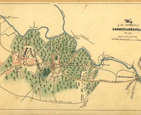
Map of the Battle of Chancellorsville, May 2, 1863

Map of the Battle of Chancellorsville, Saturday, May 2nd, 1863, 1863.
Library of Congress
Historical map of the Battle of Chancellorsville
Chancellorsville, Saturday, May 2nd 1863
Shows names of some residents.
Relief shown by hachures.
Pen-and-ink and pencil, mounted on cloth.
Reference: LC Civil War maps (2nd ed.), H131
Includes a list of names and locations of regiments and brigades.
In pencil on verso: 96.
Scale . 2 in. to 1 mile.
Library of Congress Geography and Map Division Washington, D.C. 20540-4650
Learn More: Battle of Chancellorsville