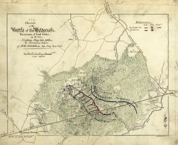
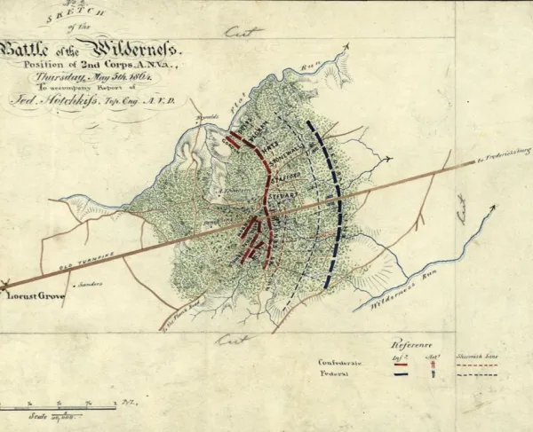
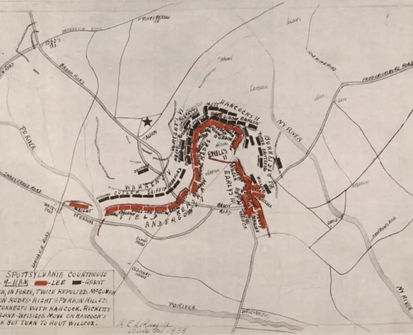
The Wilderness - May 5, 1864 by Jedediah Hotchkiss
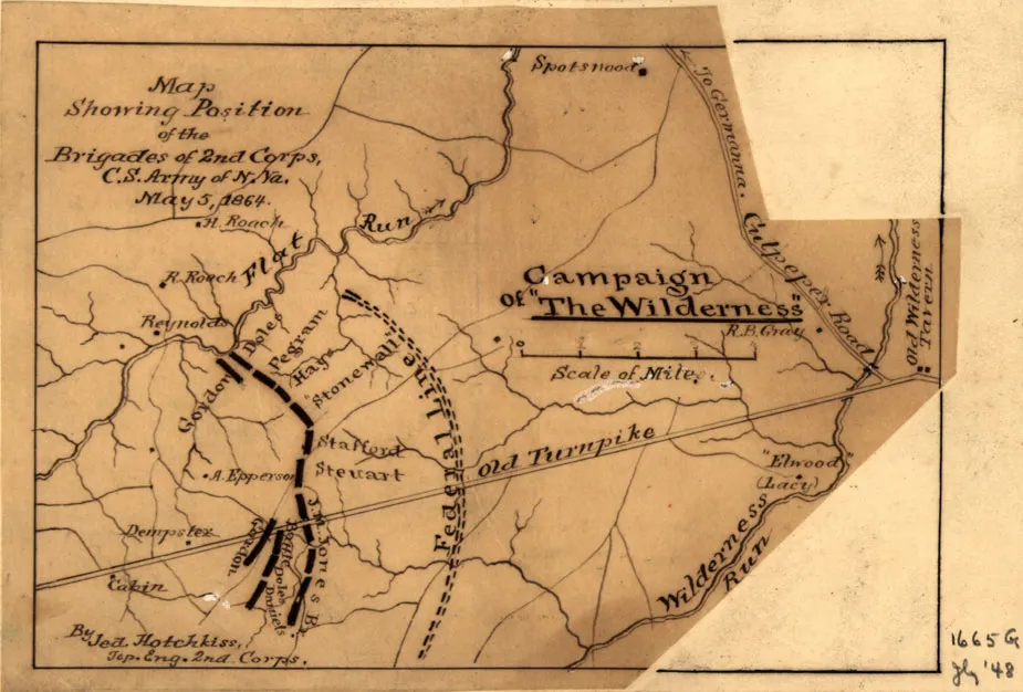
Map Showing Position of the Brigades of 2nd Corps, C.S. Army of N. Va., May 5, 1864, by Jedediah Hotchkiss
Library of Congress
Historical map of The Wilderness
Map showing position of the brigades of 2nd Corps, C.S. Army of N. Va., May 5, 1864
[Hotchkiss, Jedediah, 1828-1899]
Scale ca. 1:160,000.
Pen-and-ink on an irregularly shaped sheet of paper pasted to a larger sheet of paper, mounted on cloth.
Similar to the map reproduced in the Atlas to accompany the official records of the Union and Confederate Armies, 1891-95, pl. 83, no. 1.
Reference: LC Civil War maps (2nd ed.), H166
In pencil on verso: 34.
Library of Congress Geography and Map Division Washington, D.C. 20540-4650
Learn More: The Battle of The Wilderness