Sketch of vicinity of Fort Fisher
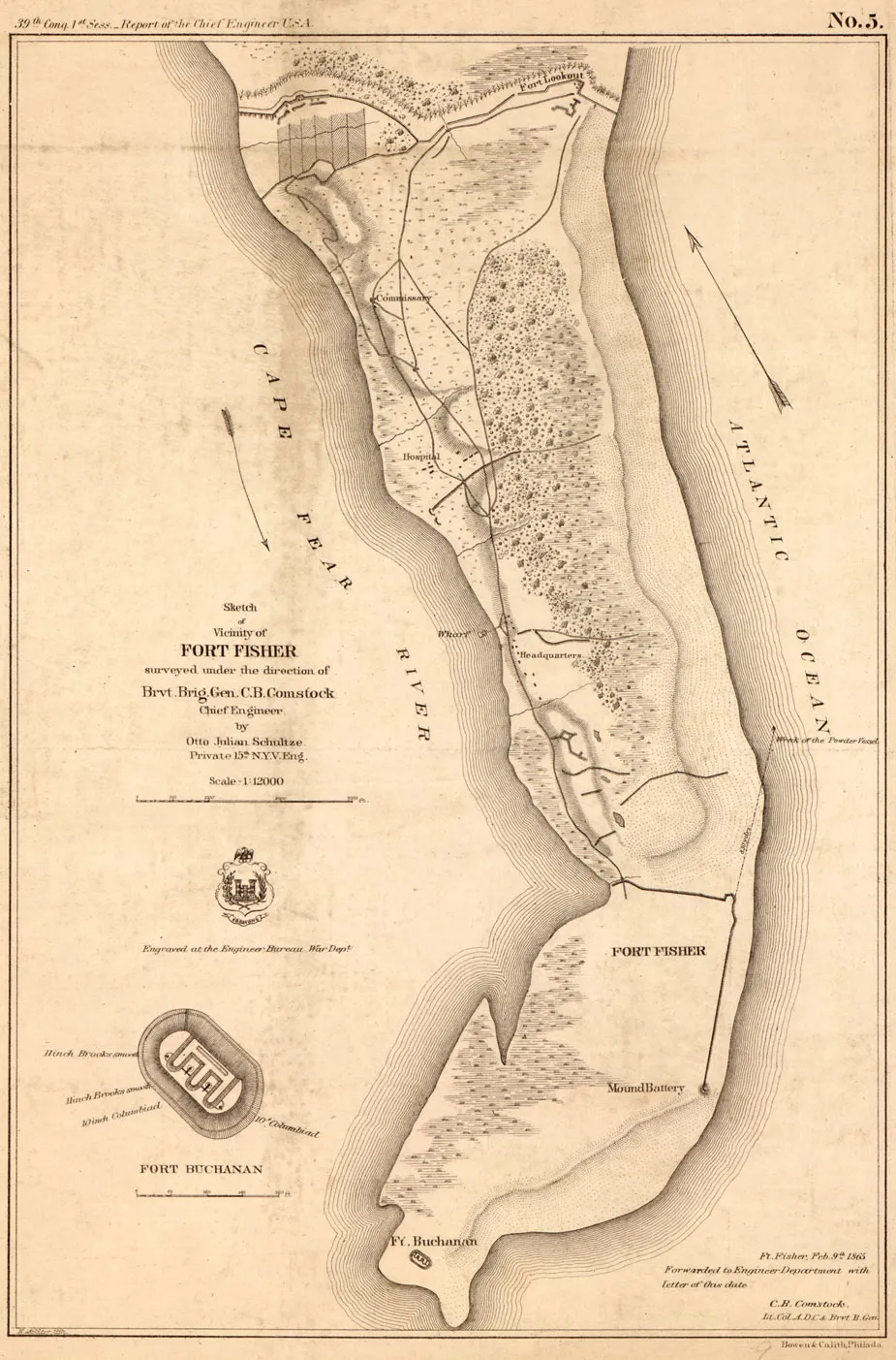
Sketch of Vicinity of Fort Fisher, 1865. By Otto Julian Schultze. Lithographed by E. Molitor. Courtesy of the Library of Virginia.
Library of Congress
Historical map of the vicinity of Fort Fisher
Sketch of vicinity of Fort Fisher, prepared by Brvt. Brig. Gen. C. B. Comstock, Chief Engineer & Otto Julian Schultze, Private, 15th N.Y.V. Eng.
[Engineer Bureau, War Dept., Washington, D.C. 1865]
Scale 1:12,000.
“Ft. Fisher, Feb. 9th, 1865, forwarded to Engineer Department with letter of this date, C.B. Comstock, Lt. Col. A.D.C. & Brvt. B. Gen.”
Includes inset of Fort Buchanan.
Relief shown by hachures.
Similar to no. 314, LC Civil War maps (2nd ed.).
Map Collection of the Library of Virginia
Civil War project no.: lva00213.
Conservation: Etherington Conservation Center, April 2004.
Library of Virginia Richmond, VA 23219-8000 USA
Learn More: The Battle of Fort Fisher