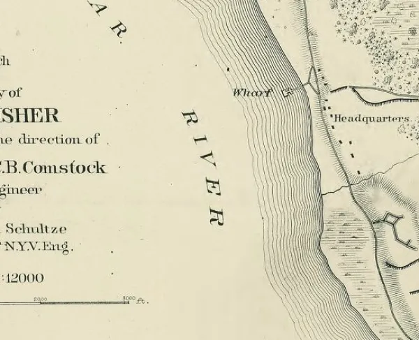
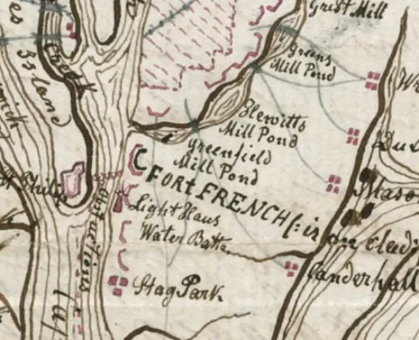
Plan of Fort Fisher and Vicinity

Historical map of the Battle of Fort Fisher
Plan of Fort Fisher and vicinity, North Carolina. Plan of second attack, January 15th, 1865.
[1864-1865]
The first assault on Fort Fisher was made in December 1864 by Gen. Benjamin F. Butler, who withdrew when he realized a direct assault on the fort would be costly, and that Confederate reinforcements were only a few miles away. The second assault, led by Gen. Alfred Howe Terry, used a large naval force to bombard the fort before landing 8,000 assault troops. Two images of the attack on Confederate Fort Fisher, one regional and one a detailed depiction of the fort and the Union assault.
Color coding indicates the location of Union and Confederate forces.
This item is from the collections of the Virginia Historical Society in the Robert Knox Sneden Scrapbook (Mss5:7 Sn237:1 p. 435).
2 images on 1 map : pen-and-ink and watercolor ; 19 x 30.5 cm.
Virginia Historical Society, P.O. Box 7311, Richmond, VA 23221-0311 USA
Learn More: The Battle of Fort Fisher