Sheridan’s Last Raid
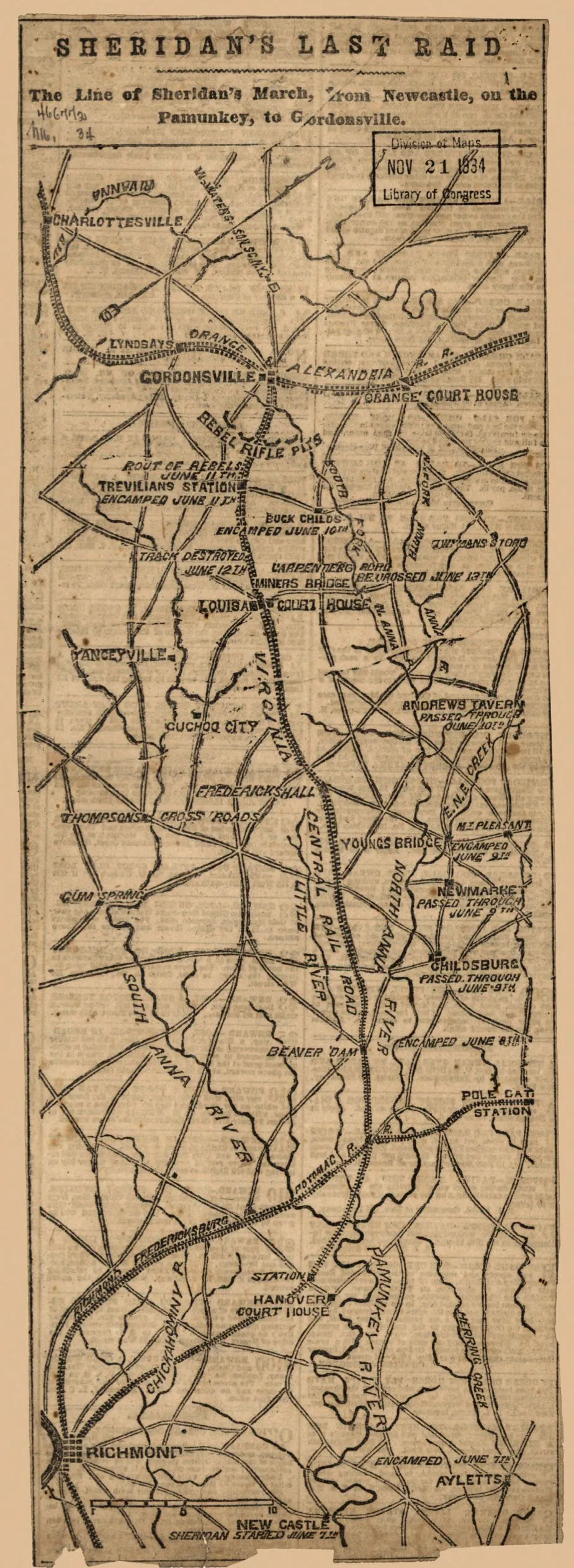
Sheridan's Last Raid: The Line of Sheridan's March, from Newcastle, on the Pamunkey, to Gordonsville (June 7–11, 1864), 1864.
Library of Congress
Historical map of Sheridan’s Last Raid
The line of Sheridan’s march, from Newcastle, on the Pamunkey, to Gordonsville. June 7-June 11, 1864.
N.Y., W. Waters [&] Son sc., [1864]
Scale ca. 1:385,000.
Reference: LC Civil War Maps (2nd ed.), 498.5
Anonymous, undated newspaper map showing the location and dates of encampments and the "route of rebels, June 11th" at Trevilian Station.
Description derived from published bibliography.
Library of Congress Geography and Map Division Washington, D.C. 20540-4650
Learn More: Battle of Trevilian Station


