Rocky Face Ridge - May 11, 1864

American Battlefield Trust’s map of the Battle of Rocky Face Ridge

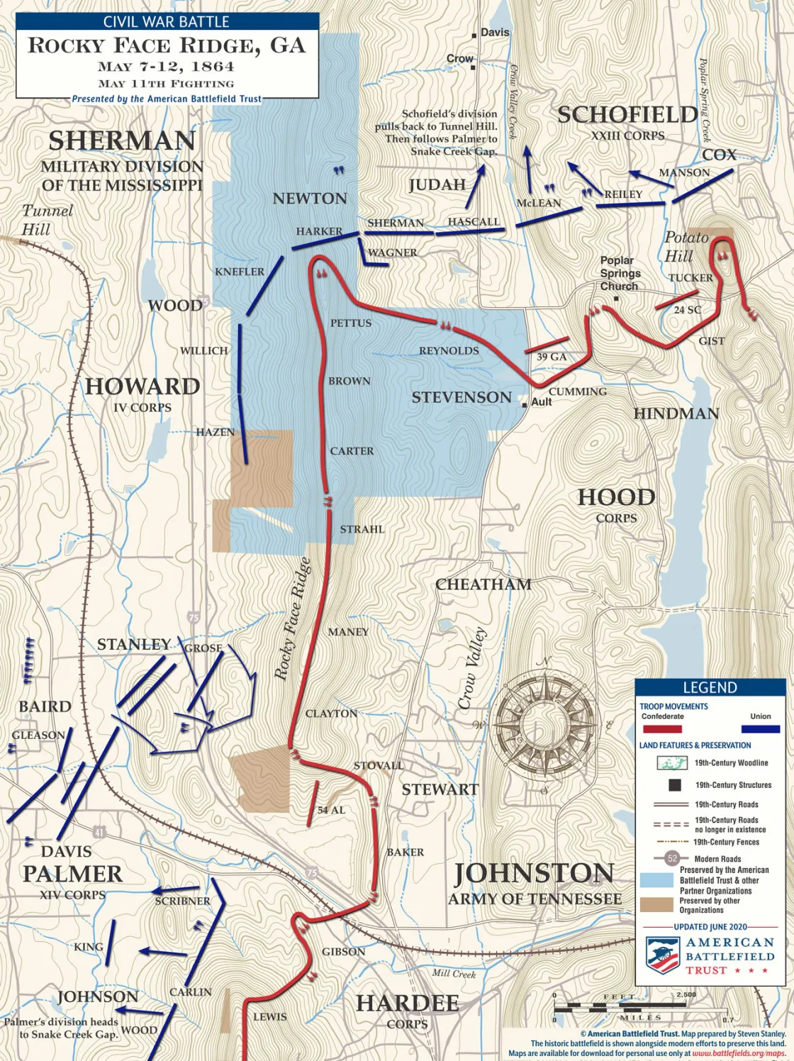
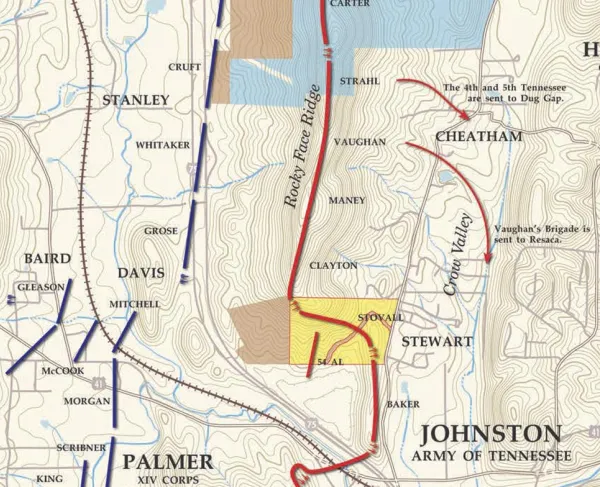
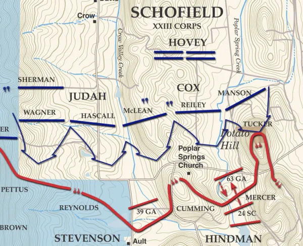
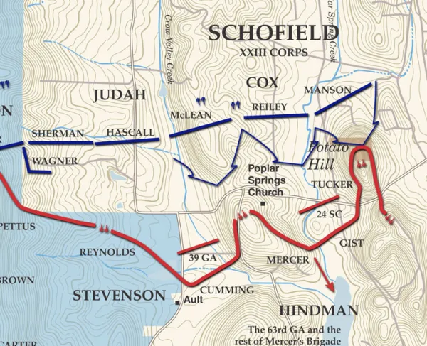
After crossing Tunnel Hill on May 7, Maj. Gen. George Thomas’ Army of the Cumberland attacked the west side of Rocky Face Ridge on May 8 and 9. Thomas’ army contains the IV Corps under Maj. Gen. Oliver Howard and the XIV Corps of Maj. Gen. John Palmer. The Western & Atlantic Railroad passed through Mill Creek Gap, also known as the “Buzzard’s Roost,” around the south edge of Rocky Face Ridge into Dalton to the east. Dug Gap, also attacked on May 8, is five miles further south (not shown). Maj. Gen. John Schofield’s Army of the Ohio attacked the north end of the ridge. On May 10, Sherman ordered Schofield and Thomas to withdraw and follow McPherson’s route through Snake Creek Gap to Resaca, 17 miles south. Palmer withdrew first, followed by Schofield through May 10 and 11.

CalltoArms
Save 77 Acres of Historic Battlefield Land in Georgia

Your gift today helps save 77 acres at Ringgold Gap, Rocky Face Ridge, and Kennesaw Mountain — where history was made — with an incredible $22-to-$1...

Related Battles

Whitfield County, GA | May 7, 1864
Result: Union Victory
Estimated Casualties
1,437
Union
837
Confed.
600
Various magazine covers stacked on top of one another, a baseball hat with an American Battlefield Trust logo and a man wearing a hoodie with an American Battlefield Trust logo design on it. Various magazine covers stacked on top of one another, a baseball hat with an American Battlefield Trust logo and a man wearing a hoodie with an American Battlefield Trust logo design on it.

Shop and Preserve

Show your pride in battlefield preservation by shopping in our store. Every purchase supports the mission.
Charity Navigator logo with 4 stars

Give with Confidence

The Majority of our funds go directly to Preservation and Education.