Positions of Fort Henry & Fort Donelson
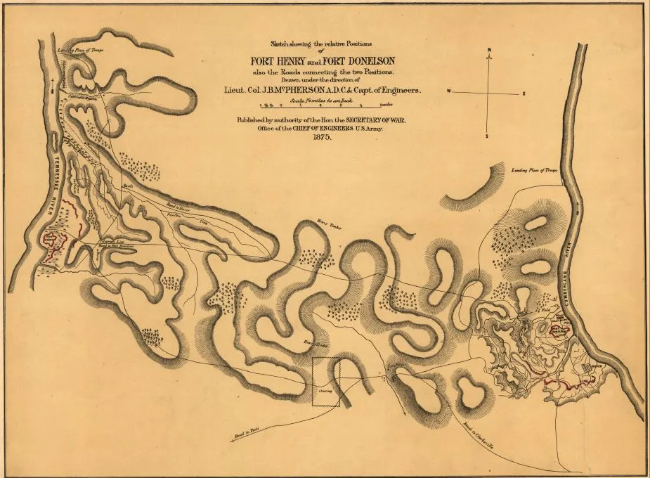
Sketch showing the relative positions of Fort Henry and Fort Donelson
Library of Congress
Historical map of Fort Henry and Fort Donelson
The relative positions of Fort Henry and Fort Donelson
McPherson, James Birdseye, 1828-1864.
[Washington] : Office of the Chief of Engineers, U.S. Army, 1875.
Scale 1:95,040; 1 1/2 miles to an in.
Hand colored.
Positions shown are as of Feb. 1862.
Relief shown by hachures.
Reference: LC Civil War maps (2nd ed.) 415
Library of Congress Geography and Map Division Washington, D.C. 20540-4650 USA
Learn More: The Battle of Fort Donelson


Related Battles
Battle Facts
Stewart County, TN | February 13, 1862
Result: Union Victory
Estimated Casualties
16,537
Union
2,691
2,691
Confed.
13,846
13,846


