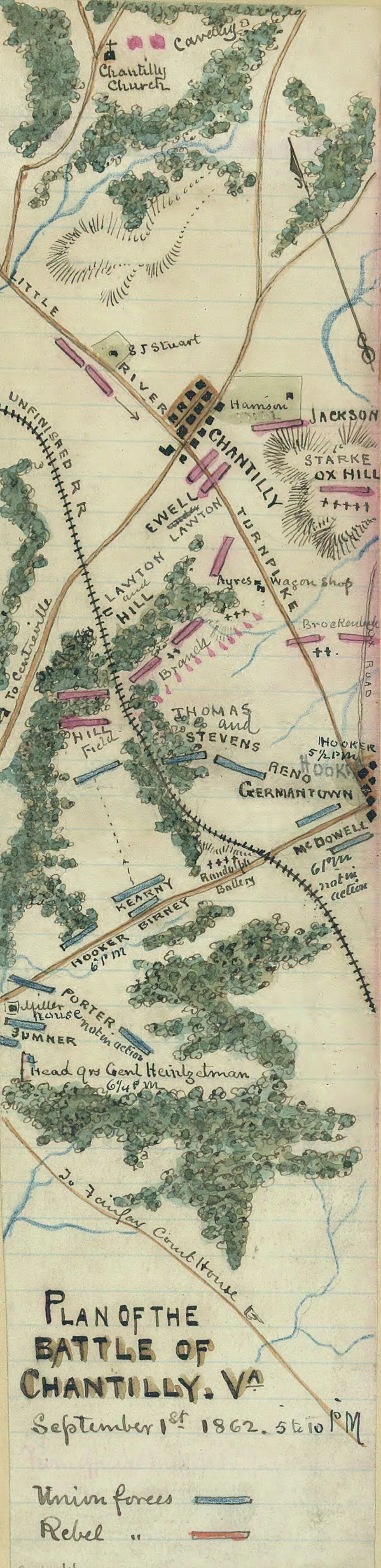
Plan of the Battle of Chantilly, Va.
Historical map of the Battle of Chantilly
Plan of the Battle of Chantilly, Va., September 1st, 1862, 5 to 10 p.m.
Sneden, Robert Knox, 1832-1918.
Concerns the placement of Union and Rebel forces, including the headquarters of General Samuel P. Heintzelman, for the last scene of fighting of the Second Bull Run Campaign, June-September, 1862. Covers portions of Fairfax County, Va., including the area around Chantilly and Germantown.
Original scrapbook housed in the Museum Department of the Virginia Historical Society (1994.80.4-525) with restricted access.
This item is from the collections of the Virginia Historical Society; please contact the institution for more information.
Robert Knox Sneden diary (Mss5:1 Sn237:1), Virginia Historical Society.
In the Robert Knox Sneden Scrapbook, 1870-1899 (p. 204).
Virginia Historical Society, P.O. Box 7311, Richmond, VA 23221-0311 USA
Learn More: The Battle of Chantilly


