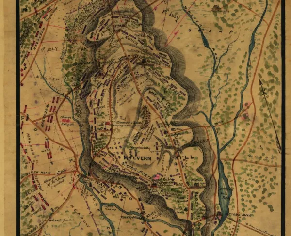
Map of the Battle of Malvern Hill
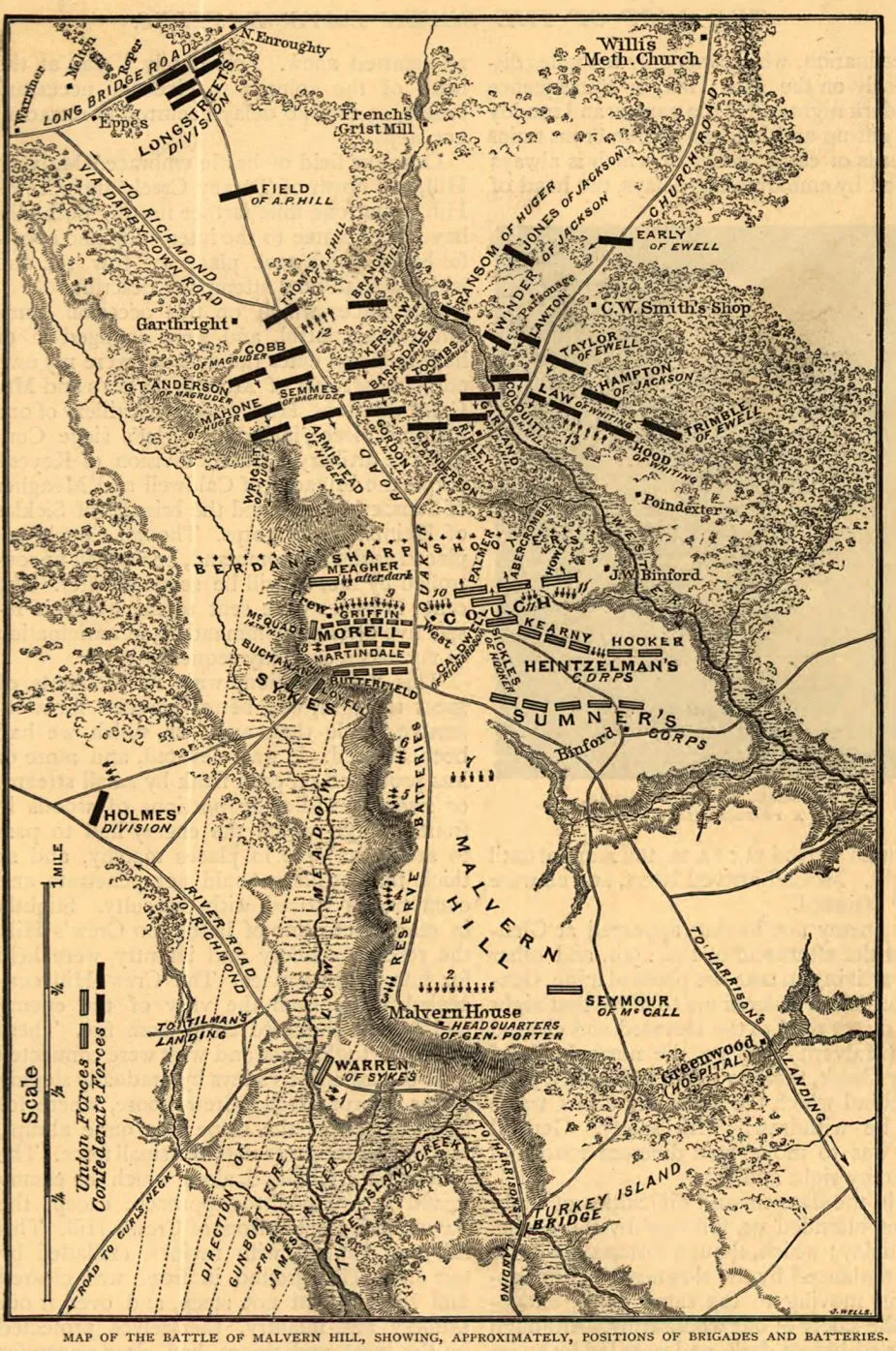
Historical map of the Battle of Malvern Hill
Positions of brigades and batteries, July 1, 1862 by Jacob Wells
Wells, Jacob.
[S.l., 1885]
Scale ca. 1:23,500.
Reference: LC Civil War Maps (2nd ed.), 560
From Century illustrated monthly magazine, v. 30, Aug. 1885. p. 617.
Gives names of commanders, roads, drainage, vegetation, relief by hachures, houses, and names of residents.
Brief description of the battle appears below the map.
Description derived from published bibliography.
Library of Congress Geography and Map Division Washington, D.C. 20540-4650
________________
The Battle of Malvern Hill was the sixth and last of the Seven Days’ Battles. On July 1, 1862, Gen. Robert E. Lee launched a series of disjointed assaults on the nearly impregnable Union position on Malvern Hill. The Confederates suffered more than 5,300 casualties without gaining an inch of ground. Despite his victory, McClellan withdrew to entrench at Harrison’s Landing on James River, where his army was protected by gunboats. The Battle of Malvern Hill ended the Peninsula Campaign. When McClellan’s army ceased to threaten Richmond, Lee sent Jackson to operate against Maj. Gen. John Pope’s army along the Rapidan River, thus initiating the Northern Virginia Campaign of the Civil War.
Learn More: Battle of Malvern Hill