The Battle of Crampton’s Gap
Historical map of the Battle of South Mountain
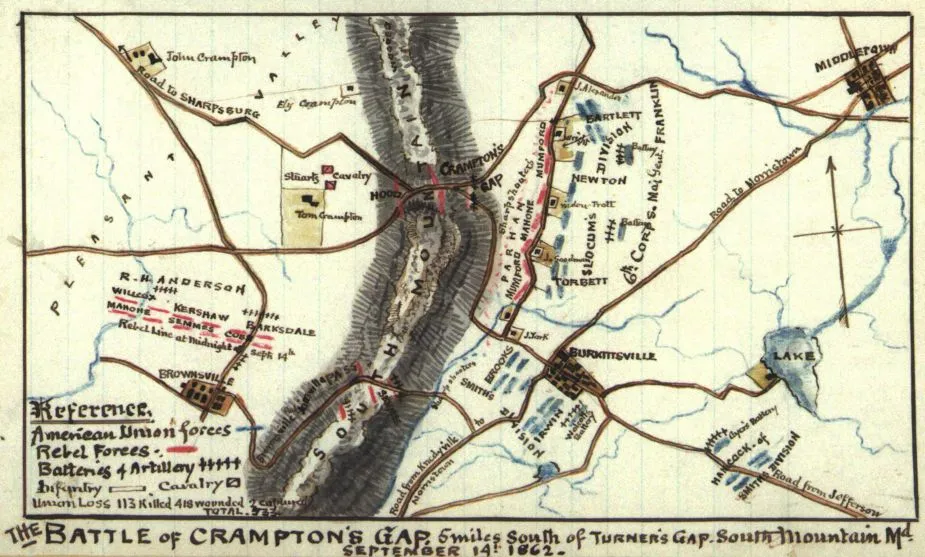
The Battle of Crampton’s Gap : 5 miles south of Turner’s Gap, South Mountain, Md. September 14, 1862
Sneden, Robert Knox, 1832-1918.
[1862-1865]
A regional view of South Mountain in Frederick County, Md., showing the location of Crampton's Gap in relation to Sharpsburg, Middletown, Burkittsville, and Brownsville, Md. Illustrates the position of Confederate forces (Anderson's division commanded by Lafayette McLaws) and the Unions VI Corps, 1st and 2nd divisions during this engagement, part of the larger Antietam, or Maryland Campaign.
Color coding indicates the location Union and Confederate forces.
Relief shown by hachures.
This item is from the collections of the Virginia Historical Society
In the Robert Knox Sneden Scrapbook (Mss5:7 Sn237:1 p. 237).
Manuscripts
Virginia Historical Society, P.O. Box 7311, Richmond, VA 23221-0311 USA
Learn More: Battle of South Mountain


