A Field Trip with Battle Apps
In October of 2011 the Civil War Trust was approached by Jim Percoco about an opportunity to engage his Applied History students in Springfield, Virginia.
Jim, who had recently learned about our Civil War Battle Apps, wondered whether we might be willing to come to the West Springfield High School to discuss our Battle Apps with his class, along with that of fellow teacher Brad Swain. Even more exciting was the opportunity join with these same students on the battlefield as they used our Gettysburg Battle App at Little Round Top and Devil’s Den.
In November we made several trips to the Applied History classrooms at West Springfield High School. During those presentations we were able to talk with the students about how technology and web-connected smartphones are rapidly changing the educational landscape. We talked about how offerings like our Battle Apps could help expand awareness of our battlefields, especially those that did not have a wealth of physical interpretation. We fielded smart and far-ranging questions about everything from the technical construct of these apps, the possible future use of augmented reality, and the preservation realities at many of our battlefields. It was quite clear that we were dealing with students who not only knew a good deal about the American Civil War, but were also very aware of the expanding role that smartphones are playing in our society today.
The Gettysburg Battlefield Field Trip
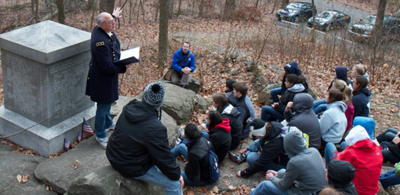
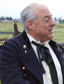
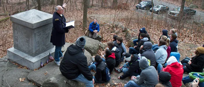
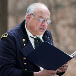
At 7:46am on a crystal clear and cold November morning, the sleek bus carrying the West Springfield students, teachers, and chaperones arrived at McPherson Ridge on the Gettysburg battlefield. Standing not far from the McPherson Barn, Garry Adelman and I – cameras and Battle Apps in hand – awaited the group. Jim Percoco, wearing a Union officer’s wool frock coat, gathered the shivering masses and moved closer to the towering Reynolds equestrian monument. After invoking the spirit of history with a tingle of his eponymous Tibetan bells, Jim went into a description of the day’s agenda and then introduced Garry Adelman.
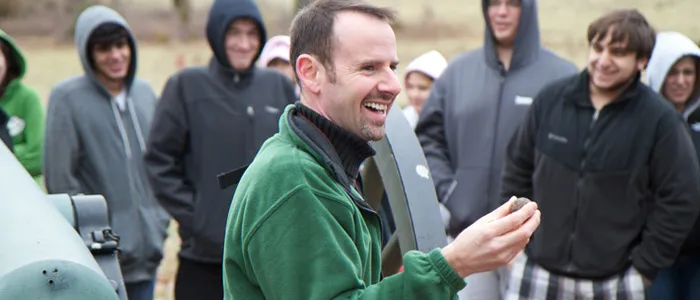
For those of you who don’t know our hyper-kinetic Director of Education, Garry Adelman is a Gettysburg Licensed Battlefield Guide and is best described as barely contained atom bomb of Civil War knowledge and energy. With Jim Percoco’s signal, Garry launched into a dynamic description of the July 1, 1863, events atop McPherson Ridge. And as I’ve seen on countless other occasions, the students of West Springfield High School, immediately bonded with Garry.
It became quickly apparent to us that this was not going to be your average high school field trip to Gettysburg. Percoco, an award-winning 32-year veteran of the Fairfax County Public School system, knew exactly how to make the most of this precious visit. There would be no lengthy visit to the cavernous Gettysburg Visitor Center. There would be no chasing of students through the Visitor Center gift shop. Jim’s approach to battlefield field trips is to spend maximum time on the actual battlefield (Yes!) and to engage the students directly in the teaching experience. At three different locations on the battlefield, the students of West Springfield High School actually presented to us.
The first student presentation, standing next to the 143rd Pennsylvania Monument, talked about the determination of Sgt. Ben Crippen to save his unit’s flag in the face of the Confederate onslaught. The second presentation, made in the shadow of the John Burns statue, discussed the brave actions of Burns on July 1, 1863, and his subsequent fame. And lastly, at Coster Avenue inside the town of Gettysburg, another presentation covered the sad story of Sgt. Amos Humiston, who was found dead clutching a photo of his young children. Each presentation was well researched and well presented.
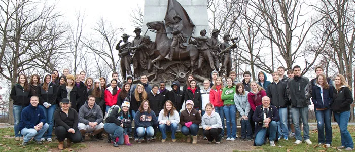
After our visit to McPherson Ridge, the students made stops near the Lutheran Seminary, Coster Avenue, the Virginia Monument on Seminary Ridge, the Longstreet Observation Tower, and sections of the Pickett’s Charge battlefield. After a quick lunch we were all off to Little Round Top and Devil’s Den.
Battlefields as Outdoor Classrooms
With a brisk wind whipping over the crest of Little Round Top, the air temperature seemed to drop to an almost Arctic level. With hoods now up and hands thrust into parkas and pockets, the students of West Springfield High School listened to Garry’s accounts of the fighting on Little Round Top on July 2, 1863. From the summit, the entire group traveled down to the 20th Maine monument where Jim delivered a powerful rendition of Theodore Gerrish’s stirring account of the 20th Maine’s exploits on the Union left. Pointing out that Gerrish was not even present at the battle, Jim locked in an important point with his students: know your sources.
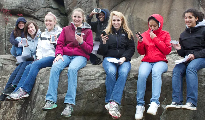
From the 20th Maine monument, the students were given more than 90 minutes to explore Little Round Top and Devil’s Den with their Gettysburg Battle Apps in hand. For those students who did not already own an iPhone or iPod touch, West Springfield High School supplied iPod touch units for the students to use. After a quick orientation on how the App worked, the students quickly split up raced off, with Battle Apps in hand.
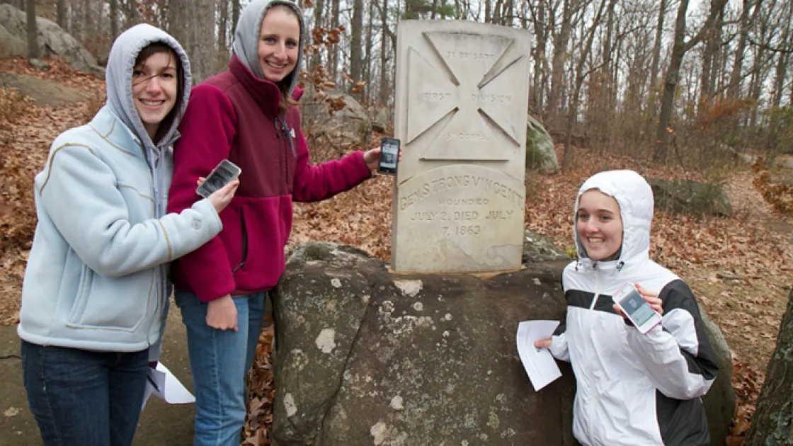
The group I followed headed for the nearby Strong Vincent marker – one of the hidden historical markers that many visitors fail to see and that our App helps to locate. There we talked about Vincent’s important role at Little Round Top. Passing over to the “military crest” of Little Round Top, we preceded to head for the 16th Michigan Monument. With the pulsing GPS blue dot steadily moving along the digital map as a guide, the students quickly grasped how empowering these apps could be. They were in control. They could visit the sites and access the information at their own pace. They could listen to the historian videos or access the primary source audio, both here at the battlefield and at home.
As we descended the rocky face of Little Round Top, I could sense the students warming to the topic of the Civil War: Where did they bury everyone?; Why did they fight down here [at the military crest] instead of up at the top?; Why didn’t everyone just run? We talked about the role of small unit cohesion (many didn’t want to let their hometown friends down or be labeled a cowards at home). We talked about the impact that local communities faced when their hometown regiments were decimated. We talked about a lot of complex topics in a short walk.
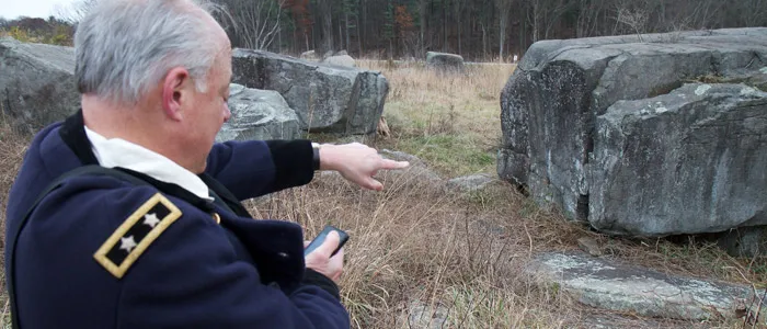
As we reached the NPS road near Plum Run, it didn’t take long before a few in our party cried out that Bullet Hole Rock must be nearby (one of our GPS-marked Points of Interest). Looking straight at the rock, we talked about how there used to be a trolley that passed through this area, bringing hosts of tourists to Devil’s Den. We wandered over to the 40th New York monument and they learned from the App about the “Mozart Regiment” – no they were not a regiment of classical musicians. And in due time we were close to the face of Devil’s Den. Many of the students were quick to fire up the historian videos available in this rich historical region. Others quickly jotted down notes on their assignment papers.
Using their Battle Apps as some sort of homing beacon, many of the students found the Sharpshooter’s Den and learned about how photographers had staged one of the most famous photos of the Civil War. And with the App guiding them forward, many found the location where the “dead sharpshooter” body had been first located and asked, "Why did photographers in 1863 stage such photos?"
At the nearby Triangular Field we talked about the intense fighting that occurred here on July 2, 1863. And with the app guiding the group to the 124th New York monument, we spoke about Colonel Augustus Van Horne Ellis and his role just before his death near the top of Devil’s Den. From there we wandered over the Den’s crest and down to the buses waiting for the students in the Valley of Death.
Did our iPhone Battle App experience go as we had thought? Very much so. Garry and I were both excited to see that the students had quickly taken to the format, stating that the App was easy to navigate and filled with interesting information. Did the Battle Apps work perfectly? Well, almost. Some students, particularly those with iPod touch units, could not utilize the GPS function. Others had trouble accessing the audio and video files, revealing a small bug in our Battle App that has now been fixed in a product update, delivered digitally; this ability to easily update the product is one of the benefits that we talked about in class of students who will no doubt, one day soon, take platforms like these to whole new levels of capability and effectiveness.
For those who believe that the American Civil War is not being taught in our schools today, I offer up the Applied History classes at West Springfield High School as a powerful example to the contrary.
Learn more about and download our full collection of Battle App guides: Battlefields.org/battleapps
Help restore Gettysburg to its 1863 appearance — and honor the stories of valor written into its soil.