Vicinity of Brandy Station
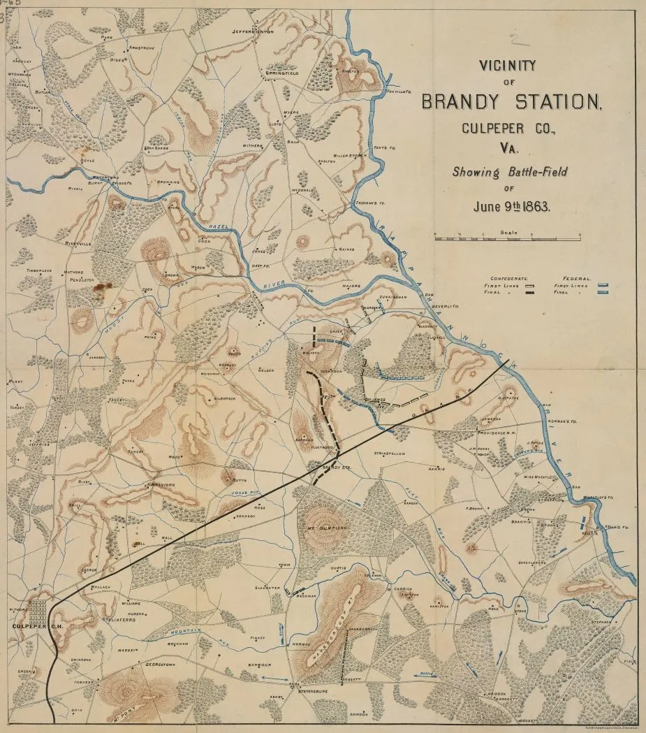
Vicinity of Brandy Station
Library of Congress
Historical Map of the Battle of Brandy Station
Vicinity of Brandy Station, Culpeper County, Virginia showing battlefield of June 9th 1863
Cincinnati : Strobridge Lith. Co., [1863?]
Relief shown by hachures.
Shows location of troop lines.
This item is in the Map Collection of the Library of Virginia
c.1, map accession no. 5190x; c.2 (negative photostat, on sheet 32 x 29 cm.); c.3 (positive photostat, on sheet 33 x 29 cm.).
Civil War Map Proj. no.: LVA00059.
Conservation: Etherington Conservation Center, May 2002.
Digital image available: 16.5 x 14.5 in.
Previously filed as: 755.383 M6 1861-1865 1863.
Scale 1 mile = 1 in.
Library of Virginia Richmond, VA 23219-8000 USA
Learn More: Battle of Brandy Station


