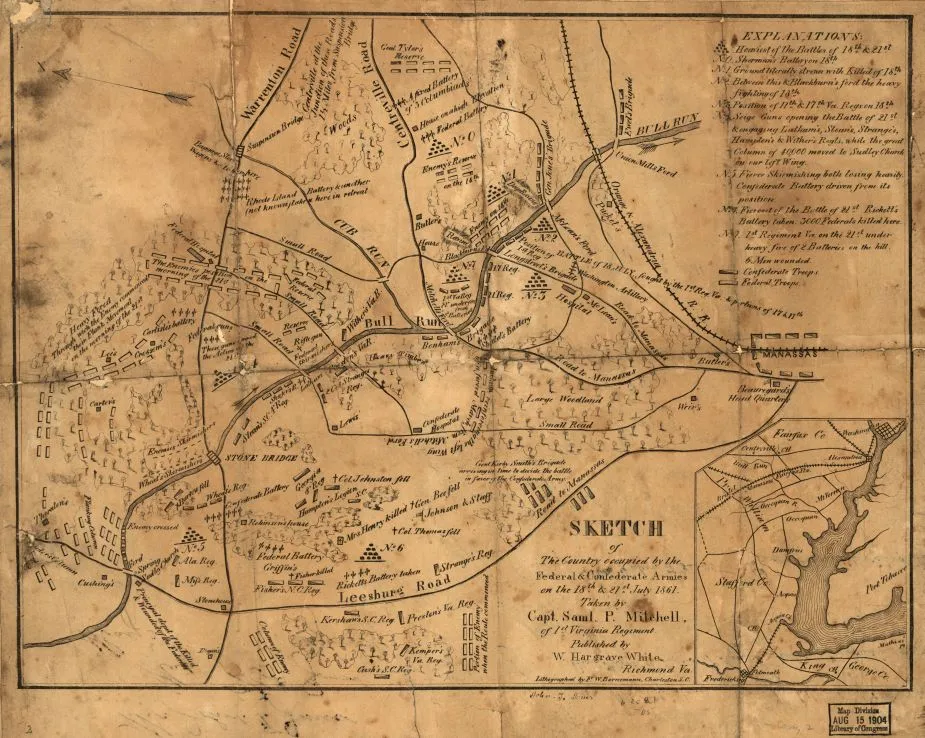
Sketch of the country occupied by the Federal & Confederate Armies on the 18th & 21st July 1861
Historical map of the Battle of Bull Run
Sketch of the country occupied by the Federal & Confederate Armies on the 18th & 21st July 1861 Taken by Capt. Saml. P. Mitchell, of 1st Virginia Regiment. Lithographed by F. W. Bornemann, Charleston, S.C.
Mitchell, Samuel P.
Richmond, W. Hargrave White, [1861?]
Scale not given.
Reference: LC Civil War Maps (2nd ed.), 566
Confederate imprint.
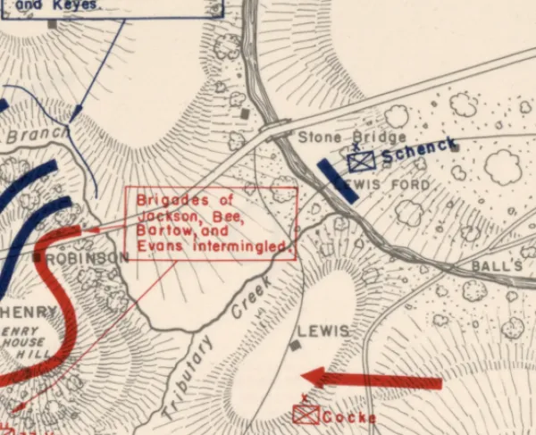
Shows troop positions, notes concerning battle, roads, "Orange & Alexandria R.R.," vegetation, houses, names of residents, and drainage.
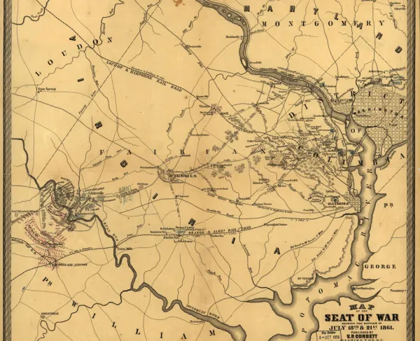
Inset: [Sketch of the environs of Bull Run from Washington to Fredericksburg.] 12 x 9 cm.
Description derived from published bibliography.
Library of Congress Geography and Map Division Washington, D.C. 20540-4650
Learn More: The Battle of Bull Run