Gaines’ Mill Battlefield - Infantry and Artillery
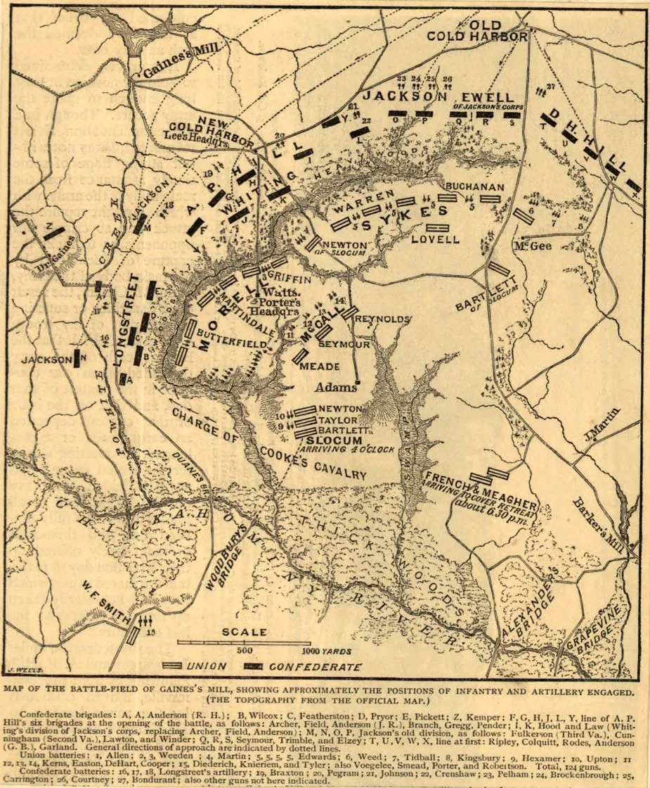
Map of the battlefield of Gaines’ Mill, showing approximately the positions of infantry and artillery engaged
Library of Congress
Historical map of the Battle of Gaine’s Mill
Positions of Infantry and Artillery on the field by Jacob Wells
[S.l., 1885]
Scale ca. 1:33,000.
Reference: LC Civil War Maps (2nd ed.), 558
From Century illustrated monthly magazine, v. 30, June 1885. p. 317.
Indicates names of commanders, roads, relief by hachures, houses, names of a few residents, drainage, and vegetation.
Description derived from published bibliography.
Library of Congress Geography and Map Division Washington, D.C. 20540-4650
Learn More: Battle of Gaines’ Mill


CalltoArms
Losing 838 Acres of Sacred Battlefield Land Would Be Unthinkable
Preserve 838 acres at Gaines’ Mill, Cold Harbor and White Oak Road — land where the nation’s future was decided. Help raise $431,350 to protect this...


