Battlefield of Winchester, Va. (Opequon)
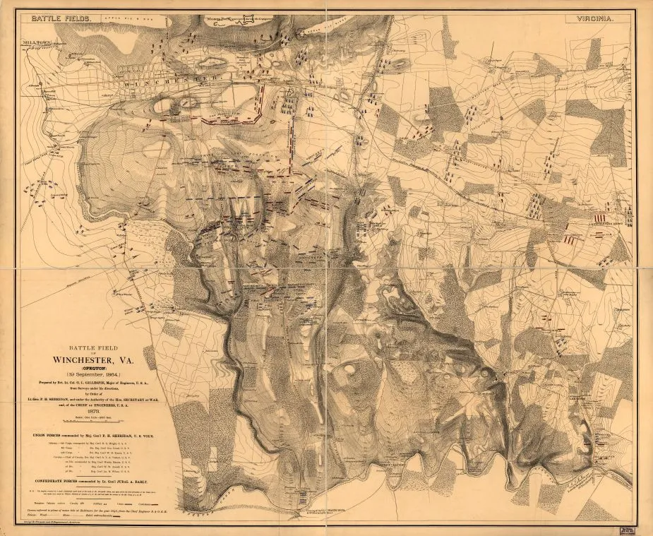
Historical map of the Battle of the Third Winchester
Winchester, Virginia on September 19, 1864 prepared by G. L Gillespie
Battlefield of Winchester, Va. (Opequon) [September 19, 1864] Prepared by Bvt. Lt. Col. G. L. Gillespie, Major of Engineers, U.S.A., from surveys under his directions, by order of Lt. Gen. P. H. Sheridan, and under the authority of the Hon. Secretary of War, and, of the Chief of Engineers, U.S.A. George B. Strauch and E. Siegesmund, Assistants. 1873.
Gillespie, G. L.
[S.l.], 1873.
Scale ca. 1:9600.
Reference: LC Civil War Maps (2nd ed.), 670
Detailed map of Winchester and vicinity showing Union positions in blue and Confederate positions in red, troop movements, names of commanders, roads, railroads, street plan of Winchester, drainage, vegetation, houses, fences, names of residents, and relief by hachures and contour lines.
Description derived from published bibliography.
Library of Congress Geography and Map Division Washington, D.C. 20540-4650
Learn More: Third Battle of Winchester


Related Battles
5,020
3,610


