Battle of Vicksburg - Tomlinson
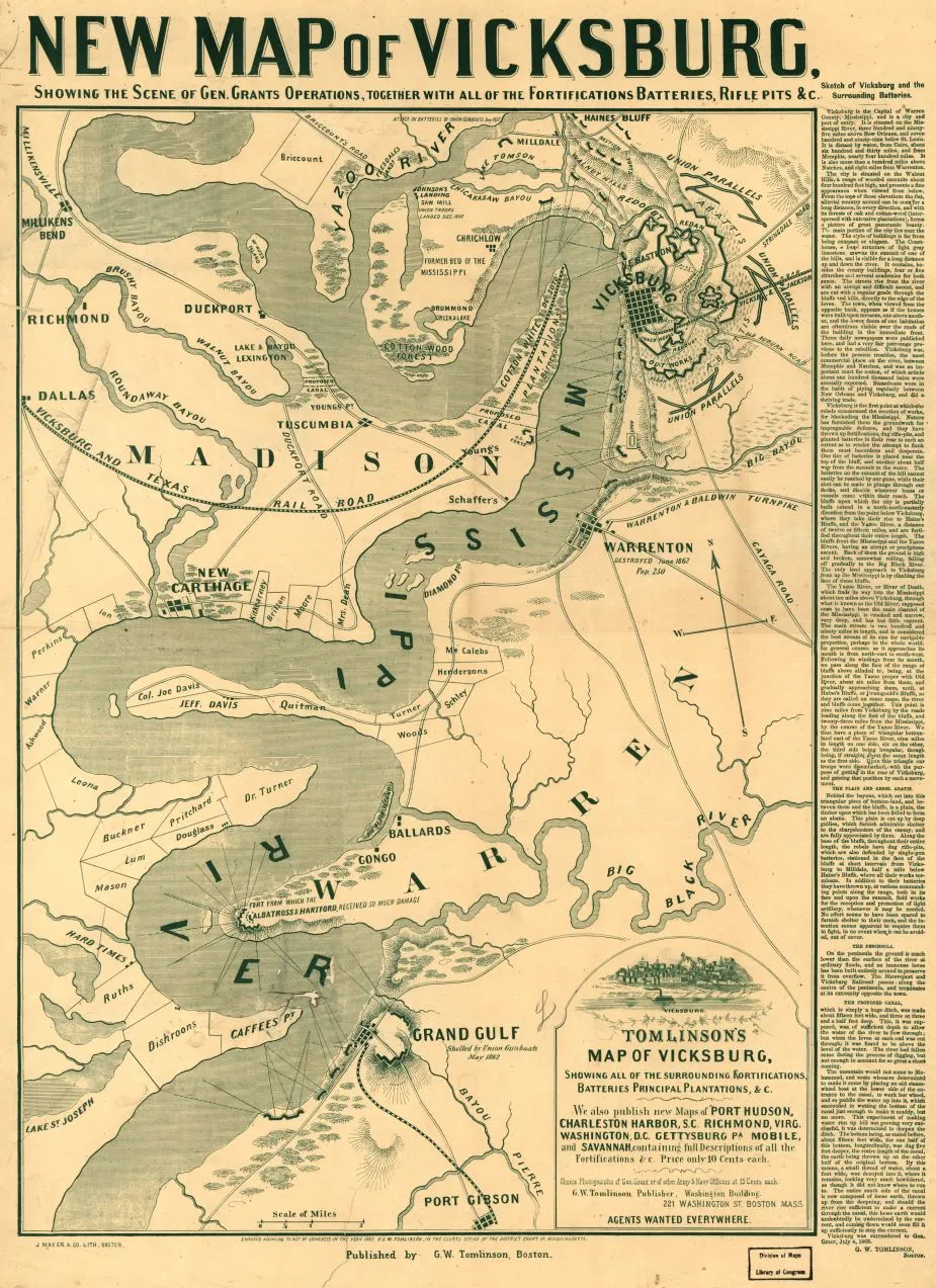
Tomlinson's Map of Vicksburg, Showing All the Surrounding Fortifications, Batteries, Principal Plantation, &c., 1863. By George W. Tomlinson. Courtesy of the Library of Congress Geography and Map Division.
Library of Congress
Historical map of the Battle of Vicksburg
Tomlinson's map of Vicksburg, showing all the surrounding fortifications, batteries, principal plantation, &c.
Tomlinson, G. W. (George W.)
Boston, J. Mayer & Co., lith., c1863.
Scale ca. 1:65,000.
Reference: LC Civil War Maps (2nd ed.), 286
At top of map: New map of Vicksburg, showing the scene of Gen. Grants operations, together with all of the fortifications, batteries, rifle pits &c.
Text to right of map: Sketch of Vicksburg and the surrounding batteries.
Map is printed in green ink and extends from Haines Bluff south to Port Gibson.
Description derived from published bibliography.
Library of Congress Geography and Map Division Washington, D.C. 20540-4650
Learn More: Battle of Vicksburg


