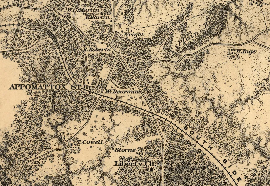
Appomattox Station Detail
Historical map of the Battle of Appomattox Court House
Appomattox Court House. [1865]
From surveys under the direction of Bvt. Brig. Gen. N. Michler, Maj. of Engineers, by command of Bvt. Maj. Genl. A. A. Humphreys, Brig. Genl. & Chief of Engineers. Surveyed & drawn by Maj: J. E. Weyss, assisted by F. Theilkuhl, J. Strasser & G. Thompson. Photolith. by the N. Y. Lithographing, Engraving & Printing Co., Julius Bien, Supt. 1867.
Michler, N. 1827-1881. (Nathaniel)
CREATED/PUBLISHED
[S.l., 1867]
NOTES
Scale 1:21,120.
Reference: LC Civil War Maps (2nd ed.), 525.2
Detailed map of the environs of Appomattox Court House showing roads, railroads, houses and names of residents, drainage, and woodlands. Troop positions are not depicted.
Annotated by an unknown hand to indicate a few positions, including "Grant Hd Qrs."
Library of Congress Geography and Map Division, Washington, D.C. 20540-4650
Learn More: The Battle of Appomattox Court House


We have a chance to save these critical pieces of history at Gaines' Mill, Cold Harbor, and Appomattox Court House for just a fraction of their full...
Related Battles
121
1,000


