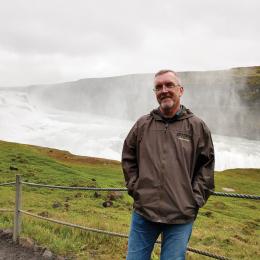
Steven Stanley
Meet the researcher and artist behind our maps


Detailed maps showing historical features and troop movements alongside modern preservation status have become virtually synonymous with the American Battlefield Trust. These hallmark products — a constantly growing body of work already in the hundreds — are all the work of historic cartographer Steve Stanley.
Over the years, Stanley has charted a career path that prioritizes strong working relationships with organizations like the Trust, parks and other historical organizations. This is work he feels “honors the men who fought and died there in both the education and the preservation of the battlefields” through his mapmaking.
“Saving our heritage has long been a passion of mine, and with my talent of producing the battle maps, I can keep pursuing that passion.”
Stanley’s love of history stretches back to high school and was nurtured by checking out Bruce Catton’s books from the local library and taking family trips to battlefields at Fredericksburg, Gettysburg and New Market.
A graphic designer by training, he became involved in historic cartography while serving on the board of directors for the Central Virginia Battlefields Trust and was approached about creating a large-format, 25-sheet map set of the Battle of Spotsylvania Court House.
“After creating that map, I started working on maps for other individuals and organizations,” Stanley recalls, “but I wanted to create my own look and feel by adding in details like modern roads grayed in the background, so that the reader or user of the map could orientate themselves on the battlefield in the present day.”
Stanley’s relationship with the Trust began in 1998, meeting the staff when he attended an event. He initially worked on individual display projects. Then, in 2000, he was asked to produce a special map for the newly merged Civil War Preservation Trust to include in a mailing to raise funds for the purchase of the Widow Pence Farm on the Cross Keys Battlefield. This means of conveying the importance of a particular property truly resonated with members.
To create a map, Stanley first must find the physical location of the battlefield, which can be surprisingly difficult for some lesser-known sites. After laying out that essential perimeter, he pulls together primary sources and other materials to begin placing troops on the battlefield. It isn’t a neat process. “My wife knows when I am getting deeply involved in creating a new map by the mess around me.”
To accurately render topographical features from the Civil War period, he typically references old maps, as the landscape may have changed significantly over time. Before the U.S. Geological Survey reworked its modern topographical maps to be more user-friendly for cartographers, Stanley had to hand draw each topographical element, a process that might take several hours — or several days, depending on terrain.
It’s the details that make a map come to life, and so Stanley adds historical and modern roads, water features — whether small streams or major rivers — historical buildings and period farm fields and tree lines. Once the base map with these physical features is complete, he turns to the action of the battle. Myriad factors contribute to determining where units were located and what their movements were during the battle.
“The maps I’ve collected have gotten me in the general vicinity, but it is really the primary and contemporary resources that get the troops moving correctly. After I feel I have the troops in the correct positions ... I will send the maps to a historian for that battle and have them check my work.”
Historians greatly value Stanley’s efforts, and in addition to his work with the Trust, he has served as the designer for America’s Civil War magazine and provided maps for more than 60 books. Recently, his repertoire has expanded beyond the Civil War, into both the 18th and 20th centuries, and he produces work for the Italian magazine WARS.


