Fort Pownall
207 Lighthouse Road
Fort Point State Park
Stockton Springs, ME 04981
United States
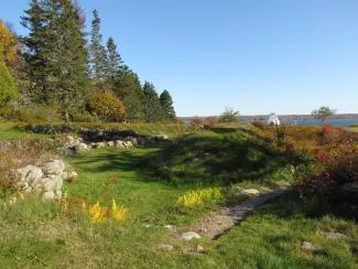
Remains of Fort Pownall
Maine Historic Preservation CommissionFort Pownall overlooks where the Penobscot River meets Penobscot Bay. Originally, the fort's outer walls measured 90 feet long and 10 feet high, surrounded by a 15-foot-wide, 8-foot-deep moat, with palisades in the middle for added protection. A drawbridge let people enter the fort. Inside the walls stood a forty-four-foot blockhouse, two stories tall, with diamond-shaped flankers at each corner for riflemen. The whole fort was constructed of squared timbers, dovetailed at the corners and treenailed. Built to defend the Penobscot Bay during the French and Indian War, it never saw action. In 1775, during the American Revolution, British forces confiscated all guns and ammunition from Fort Pownall. That same year, Colonel Cargill of the Continental Army burned the fort and filled the moat, making it an early act of patriotic sabotage and a symbol of escalating British/American tensions in Maine. Presently, only the foundations and earthworks remain.
The remains of Fort Pownall contain interpretive panels and a stone marking the original burial site of Gen. Samuel Waldo, for whom Waldo County and Waldoboro are named.