Part of Charleston Harbor, embracing forts Moultrie, Sumter, Johnson, and Castle Pinckney
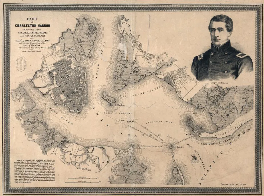
Part of Charleston Harbor, embracing forts Moultrie, Sumter, Johnson, and Castle Pinckney
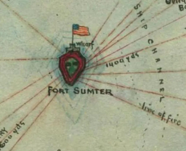
Historical map of the Battle of Fort Sumter
Part of Charleston Harbor, embracing forts Moultrie, Sumter, Johnson, and Castle Pinckney, also Sullivan, James & Morris islands; and showing the position of the Star of the West, when fired into from Morris Island.
Perry, George T.
Philadela., Lith. P.S. Duval & Son, c1861.
1 map, 35 x 48 cm.
Library of Congress Geography and Map Division Washington, D.C. 20540-4650
Digital ID
http://hdl.loc.gov/loc.gmd/g3912c.cw0374000
Learn More: The Battle of Fort Sumter